Basstravaganza 2010, Part III
Note: The first section of Basstravaganza2010 deals with my trip thru British Columbia. It is posted onto another blog site:
This section covers my trip thru the US, beginning at the start of August.
Also, in response to questions from non-bass fishermen, who ask me what I do with all these fish I kill, be advised that all fish appearing in this blog are released unharmed. Except for one unfortunate sheephead.
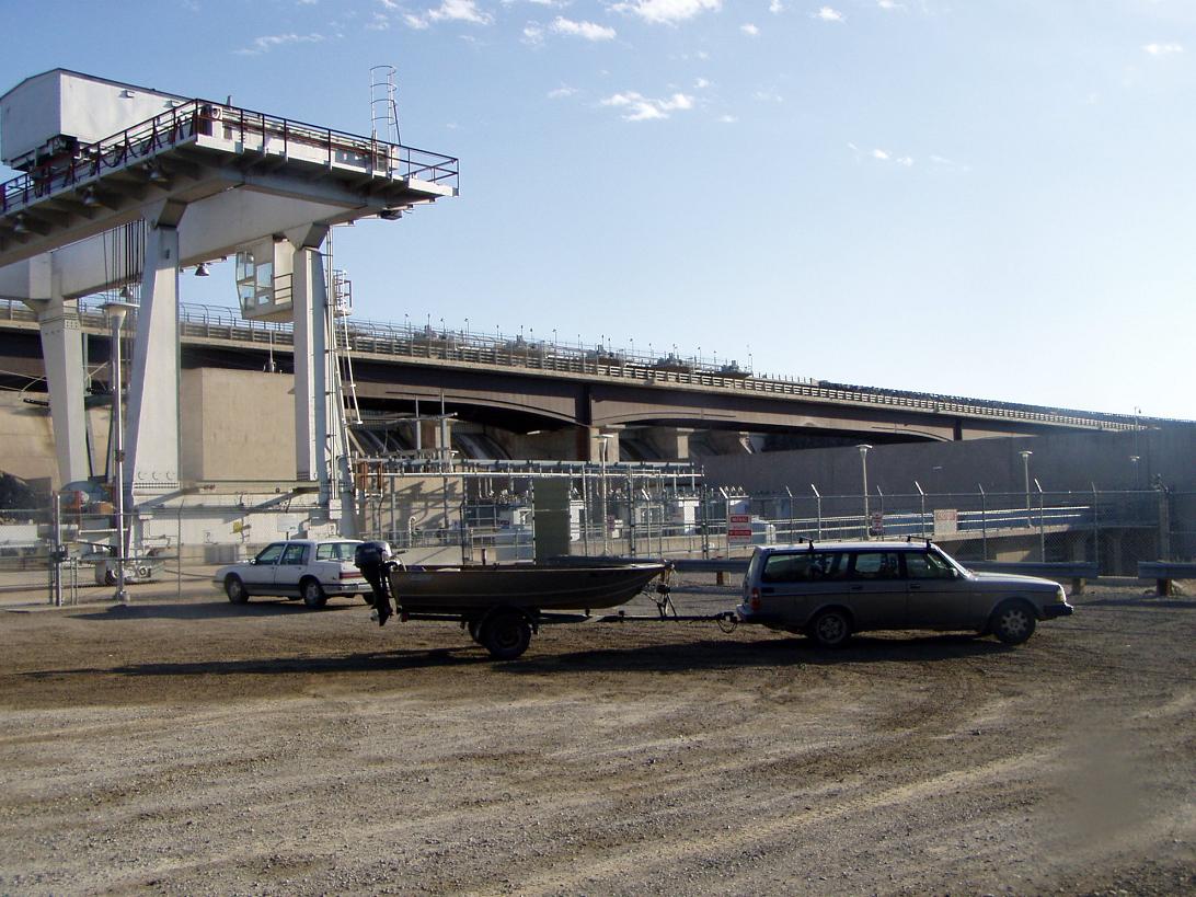
After returning from my trip to BC I was initially hoping to take right off again on another, larger trip. But I had too much to do – including major repairs and upgrades on the boat & trailer, and moving out of my apartment. I spent, a horrid month of 100F temps in Ashland, and was finally all moved out of my apt on Aug 1, hoping to leave the next day. Spent all day Aug 2 arranging and stowing stuff in my storage unit and prepping to leave. This is an insane concept – quitting my job and moving into my car for a long range bass trip. There is no way I will ever be truly prepared for insanity, so why spend the effort? Better to leave now and let the chips fall as they may. I am just about to leave my storage unit in the evening when I have my first catastrophe. Since this journey will undoubtedly be a litany of catastrophes, I will refer to it as Cat 1.
I have purchased an account with Verizon, including a little chip called an “air card” that will link me up to internet and email all across N America. I have too much stuff in my car, and when I open the door my laptop computer falls out and lands right on the air card, smashing the USB connection. I must race up to the Verizon store in Medford to get there before they close at 8 PM. I say hurried goodbye to sister Barb, and head up to Medford. Turns out that I must purchase a new air card for $189. When we go to load in the new card Windows Vista decides it is time to install 61 upgrades, which takes about 45 minutes. Did I mention that I hate Windows Vista, and Bill Gates for creating it?
I get the new chip and head over Crater Lake Hwy to Hwy 97, cuz I want to fish Wickiup Reservoir at dawn the next morn. I went there one evening recently and caught 2 nice 20” brown trout. At 3 PM I am on the road to Wickiup when I hit a roadblock. Highway repairs. Turns out that the guy ahead of me was going to exactly the same place, but his van died at the roadblock. So I drive him up to Wickiup, drop him off at his friends campground, and launch my boat;
This is volcanoland, where recent lave flows have altered hydrology. Water may disappear at one spot and magically come gushing out of the ground miles away. At Sheep Bridge, my target, two big springs come gushing out of the earth about 100 feet apart. (should have taken my camera along!) Although both are much larger in terms of flow than Bear Creek in Ashland, they must be 2 of the shortest watersheds in the state - one is about 50 ft long and the other about 75 ft.
This morning I am skunked. Although there are many fish swirling in the upper Deschutes River channel flowing into Wickiup, probably kokanee waiting to spawn, I catch no browns. So I load up and head off. Not a good omen. Maybe I will make this huge trip and never catch a fish, or even get a bite?
Aug 3
I have no cubicle to report to on Monday morning, so I am not in a hurry. I have decided to avoid the big freeways, miss out on all the Wal Marts and superstores, and travel along 2 lane roads wherever I can. I want to see the heart of America, where things are a little different, instead of seeing where everything is the same. I head back to Hwy 97, north up to La Pine, and then turn east on Hwy 31, where I have never been before. I say goodbye to the Cascades - represented here by the 3 Sisters - and to the ponderosa pine forest, and head east across the rolling sagebrush.


Then I come to the Christmas Valley, where they mine groundwater to grow hay. Suddenly the earth is green again, and clouds of yellow sulfur butterflies cavort among the alfalfa fields. How long will this fossil water last, and what will happen when it runs out?


Here is an image from Google Earth. You can see the circular rim of Fort Rock to the W. The bright green circles are irrigated hay fields watered from wells that feed center pivot irrigation. The dark areas are lava flows of black basalt that occurred so recently that no vegetation has been able to grow on them yet.


The 2 lane county hwy I am on tees into Hwy 395, which heads NE to Burns.

Most watersheds drain to the ocean, but eastern Oregon does not. The little water that falls around drains out into the desert, where it dries up or seeps into the ground long before it reaches the sea. At the bottom of this inland basin lies Malheur Lake, a huge national wildlife area south of Burns. At the narrows where the highway crosses, the lake is mostly a sea of grass, but in wet years it can expand much larger.

After crossing the narrows I will take Sodhouse Lane, a dirt road, east to New Princeton.


I am out of the Great Basin now, and into the Snake Watershed. I miss seeing the Owyhee Canyon in the dark. East of the river I pull over and lay my foamy out on a plywood sheet in my boat. A refreshing and wonderful sleep on the high desert.
Aug 4
At dawn I stop for gas & coffee in Jordan Valley, a pleasant little community where they somehow find enough water to grow hay. This used to be mining county, and there is a neat little mining museum (closed) with a story in the window about Joseph Smith, a miner who was killed by the arrow shot by a native American. “He followed no creed. The world was his stage. His only motive was to do good.” Sounds like a great motto. I wouldn't mind using it myself, if it was not already taken.
Coming down out of Jordan Valley is a steep canyon leading down to the Snake River – the Great River of the West. Incomprehensibly huge lava flows from what is now central Idaho forced the river channel into a great arc to the south. Huge lakes dammed up behind lava flows and ice dams (during the Ice Age) would burst out periodically sending massive floods scouring down to the Columbia. Hundreds of thousands of emigrants migrated along the Oregon Trail which followed the Snake across Idaho. What used to be a ribbon of water flowing across a parched and desolate desert is now a series of giant reservoirs that divert the river's waters into pipes and canals back over the landscape. It is stunning to see the green agricultural panorama spreading out below, as if someone had taken the state of Iowa and moved it into the western desert. I am out of Oregon now. No turning back.
Prior to reaching the river I come to an intersection where signs tell motorists that all vehicles towing boats must stop for inspection. The guy at the inspection booth, who is all business and wears a US Marines T-shirt, is concerned about invasive species. It is people like me, who trailer boats from one watershed to another, that are the biggest threat. In a civilization that depends entirely on piped irrigation, like the Snake Valley across S Idaho, zebra or quagga mussels would mean basically the end of the world, he says. If they get introduced they will clog the pipes, and there is no solution but to dig up the pipes and replace them. I tell him I do not plan to fish or even launch my boat in Idaho, so he installs a coded wire between my bow and trailer – a kind of chastity belt for boats. If this wire is not intact when I exit the state I am in big trouble. He also tells me that zebra mussels have recently been found in the Rogue watershed – something I have never heard of. I think he is wrong, and I can find no mention of zebra mussels in the Rogue watershed with a google search. What if? Has the WISE Project considered the implications of zebra mussels?

Hwy 55 crosses the river before heading into Nampa. I stop and talk to locals. They say there is great SM bass fishing in the river, which is too cool for LMs in the main channel. I am tempted to try, but I remember my boats wire tag, and my promise to the marine. I head on across the river and up the bluff into Nampa.


I have not had any major catastrophes for a couple days, but this morning I narrowly avoid utter disaster. I am traveling along the Oregon Trail, where hundreds of thousands of euro immigrants traveled thru a land that was not theirs. Not surprisingly, the original nhabitants were not always amused. Near this location in 1860, a wagon trail led by the Utter family was attacked by native Americans, resulting in the greatest loss of life in the history of the trail.
http://www.idahoocta.org/Utter_Summary.html
They should have driven in Volvos, which are safe.


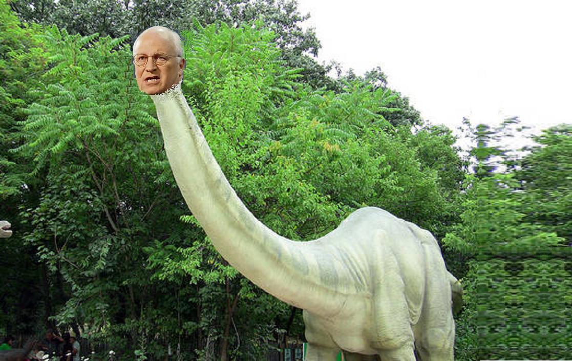
In this part of the world they have Sinclair gas stations, one of which used to be down the block from where I grew up. I thought they were extinct, like their brontosaurus logo.

But Sinclair stations are alive and well in Idaho, where prehistoric reptiles still roam the landscape, not to mention the halls of politics. I come around a bend and suddenly the hugest and ugliest reptile that ever lived comes charging out of the trees. It is the fearsome cheneysaurus, a vicious cold blooded killer responsible for the slaughter of hundreds of thousands of helpless people. It snaps at the Volvo just as I stomp on the gas pedal. Just missed – a narrow escape!
You can clearly see the difference between the irrigated and non-irrigated lands in these pics.

The dark layer on top of the bluffs is lava. Giant lava flows poured down from N Idaho until they totally covered the landscape. This is what forced the Snake R to the S, where it now flows along the edge of the soldified ocean of ancient lava.


(Note – from this point on the pics get real blurry, I think because of my own sweat that fell upon the lens. I did not download the pix for days later, and did not realize what was happening.)


Near Bliss, the river is suddenly a river again. No dams, no reservoirs here. This is rafting country, and it sure looks like fun on a smoking hot day.


Then into more canals and more ag land, generated by the Milner Dam. This is where it all started in 1904 – the conversion of S Idaho from desert to industrial agriculture.


Aug 5
In the morning I reach gigantic American Falls Reservoir, which is so big it stretches over the horizon.


The Snake is curving north here, around the rim of the giant lava flows that pushed its channel south. Further up the valley is Pocatello, where they carve mountains away to make fertilizer. When I first saw this scene in the morning sun I assumed it had to be a coal strip mine, but in fact they are digging up an entire mountain and grinding it into fertilizer at the massive Simplot plant. Then shipping it off in rail cars.
What would Lewis and that other guy think if they had seen this?


2 redtail hawks were watching me, an one kept calling and even flew a loop over my head


The Oregon Trail continued W from here down the Snake R. The California Trail branched off to the SW from Fort Hall into what is now Nevada. The Applegate Trail, which also lead to Oregon, followed the California Trail across Nevada before heading N again into Oregon.


The commanders quarters did not look too bad – better than my apartment in Ashland.


There is a small side channel below the road. Looks very fishy, so I go down to have a look. Sure enough, there are nice trout hanging under the lip of the cliff. I might want to come back here and fish some day!


The river turns north and heads up to its source in Jackson Hole in the Grand Tetons, climbing rapidly now and picking up velocity. Swarms of rafters are floating down. The river has become a theme park for thrill seeking geek tourists.


I stop first and walk onto the bridge over the Snake, to capture one more image of the great river as it exits from Jackson Hole. It is time for another crisis, and this is it. Cat III. The long telephoto lens on my old faithful camera is pointing at an angle instead of straight ahead., and the camera will not work. I must have sat on the camera, or bashed it against something. A hopeless situation. I try to force the lens back into place, but it won't move. The camera is toast. I miss my last shot of the Snake.
Dejected, I start up the Hoback as the sun goes down. The river is named after John Hoback, one of 60 members of a party funded by John Jacob Astor in 1811, sent to examine the area explored by Lewis and Clyde a few years earlier. Upon reaching the Pacific Ocean they founded the town of Astoria.
The scenery is getting prettier, and I regret missing the pics. Finally I reach a brilliant red rock canyon, and I can't stand it any more. What have I got to lose? I grab the tele lens and reef hard, and it snaps back to where it is pointing before - straight ahead. Probably not recommended procedure. But the camera still grinds hopelessly when I try to turn it on. So I push on the lens and it pops back towards the camera. I figure it must be totally ruined now, but I turn it on and it works fine. When I get done catching all the fish east of the Mississppi I have a new career waiting for me – camera repair man! Now, if I can just hire a lens cleaner guy...


I roll easily down the east slope of the mountains now, staying on Hwy 191 thru Pinedale. I cross the track of the Oregon Trail again. The emigrants would have been desperate for water here. Why didn't they wait another 150 years until there were convenience stores along the way, selling coffee and slurpies? Always in a rush. Not me, who is retired and in no hurry. At Farson I turn back NE on Hwy 26, staying as close to the trail as I can. I pull over in the dark and make my bed in the botel. Refreshed by a couple of swims, I let the cool breezes of the high plains drift me off into sleep. Hey – I can understand how the cowboys got so sentimental about all this.
Aug 6
I awake to a glorious sunrise. The mountains, which I have conquered, are far behind me to the west.


Shortly after, I come to another sign marking the continental divide between the Green River (Colorado watershed) and the Sweetwater (Mississippi watershed). Once again I am back in the watershed where I was born. There is no visible crest or height of land here, just a sign marking the divide.


I pass an abandoned molybdenum mine.


I come upon the spectacular Red Rock Canyon, which heads back west towards the mountains.


While am taking pix of the canyon I see a parnassus butterfly – only found at high elevations.


The hwy passes some cool looking rocks.

I head up to Lander to get gas. All of a sudden the emptiness of the prairies is replaced by cattle ranches and hay fields. This is a pretty big town. I even find a Radio Shack where I buy a mouse for my computer. I ask the guy at the gas station why so many people live around here, but nobody lives anywhere else. He says, “That's just the way it is in Wyoming.”
I head back down to Hwy 287, and follow it SE along the Sweetwater. It might almost be fun to ride along here in a covered wagon.


Antelope here.


At a rest stop there is a Saturn V rocket booster, or is this a big cannon?


Aug 7
I awake invigorated. Almost out of Wyoming now. I follow the freeway east, seeking gas and coffee. I find both in Spearfish, South Dakota, gateway to the Black Hills. I have often wanted to visit the Black Hills – sacred heart of the Sioux Nation. They are carving a mountain into a statue of my hero, Crazy Horse. There is also supposed to be another mountain with the heads of 4 white guys carved into it. Politicians of some kind. I decide to go check it out.
It is odd to pull into a gas station with 8 pumps, and find every one occupied by a Harley Davidson.

I see signs pointing to a historic fish hatchery. The town is called Spearfish because the natives used to spear fish for food. What kind of fish? Not trout. The streams of the Black Hills are cold and clear – ideal trout habitat. But historically they never had any trout in them, because the streams drain out of the hills into dry sagebrush plains and disappear. There was never any way for trout to get up into the streams from anywhere else. All that changed when they made the hills into a national park. The park service decided that they had some nice streams in the park so they wanted to add trout, and they built one of the first trout hatcheries in the nation – the D.C. Booth hatchery constructed in 1896. Although nowadays commercial and ag development upstream from the hatchery have polluted the water to the point that fish will no longer spawn in it, the hatchery still rears fish hatched in other places.


The Black Hills are a scam. First off, they are not black, they are green. Second, they are not hills, they are mountains. The Sioux Nation received title to this land as a reservation, their sacred heartland. Then a lieutenant named George Custer and his troops found gold in a stream here. He returned with an army and chased the indians out. A mad gold rush ensued, totally in violation of any laws. Wild Bill Hickok was murdered here. The native people are an ancient memory now, and over $800 million in gold has been extracted, and they are still digging. But the millions in gold are pocket change compared to the millions now being extracted from the pockets of tourist who come up to pay for fake history and cheesy knick knacks. The Black Hills have become a ginormous tourist trap – Tofino BC on steroids. Are those really mountains, or just scaffolding painted green to fool the tourists? Like the trout in the streams, everything is planted to generate interest from tourists who will spend money. And spend they do. There ain't much else to do in SD, so they all come here where the roads are curvy, and – Hey what are those green things...TREES!
Imagine small bits of Las Vegas scattered around a small cluster of mountains, where any tacky sleazy excuse to separate tourists from their money is valid. And this weekend, swarmed by uncountable hordes of bikers.
At the top of the mountain is the town of Lead, where they still mine from the big pit.


But you are not supposed to look into the pit without paying the tourist trapper. (I stuck my camera around the fence and stole a pic anyway.)


I pass over the Missouri River in the dark. Nothing to see here, I have been here before. East of the Mo R the air changes. It is becoming moist, full of earthy smells, manure, hay, plowed earth. I have escaped the dry rangeland and made it into the agricultural heartland of America. Later I have to stop again for gas. The place is swarming with bugs. Zillions of little beetles buzzing around the lights.


Aug 8
I wake up late with a hot sun burning. On the rest stop lawn alfalfa butterflies are everywhere. These are the common butterflies of my youth. Seldom seen out west. Don't know why. Now I know I am getting close to home.


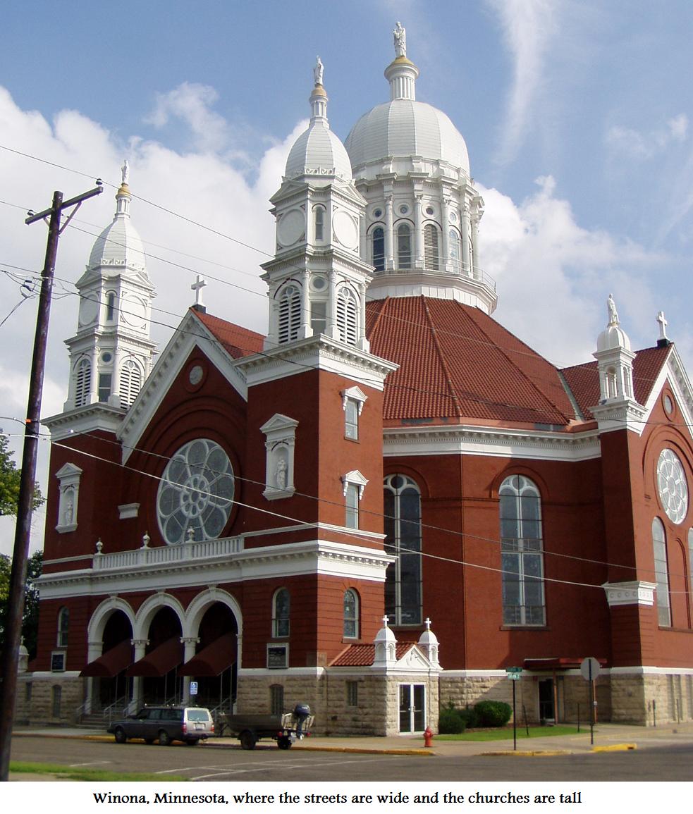
I have decided to head to Trempeleau, Wisconsin, which is directly across from Winona, Minn. Used to fish there with my dad as a kid. And since this trip is about revisiting my past lifetimes this is a good place to start.
Heading in to Winona I stop to take a scenery pic, and I see a red admiral butterfly. The house I grew up in faced exactly N-S, so in the late evening in summer the sun would shine of the north wall just before setting. Then, and only then, the red admirals would perch on our house.


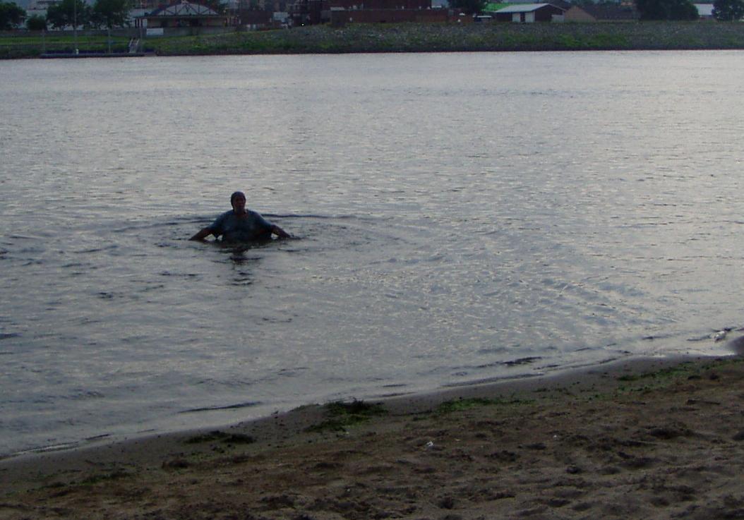


It is incredibly hot and muggy. But I cannot stand in one place for more than a few minutes, or the state birds will find me. We used to fish at nite off the end of the wingwall on the locks, and there are still people fishing there tonite. Nothing has changed in over 40 years since I have been here last.


The big river now is totally dammed, all the way from Minneapolis down thru Illinois. Each dam has a lock to allow passage for massive strings of barges which are pushed up and down the river by towboats. (This is what they are called, even tho they push their cargo along instead of pulling it. Go figure.)


The barge string is too big for the locks, so they must split it in half, and send one half thru at a time. When the 2nd string comes thru the captain comes out on deck and tries to chat with me. Lightning is flashing on the Minn side. He tells me there is a storm approaching, and I will need an umbrella. Even tho he is only 100 ft away we have to shout to be heard over the hum of 6,000 idling diesel horsepower. I try to tell him how much I respect the people who do this job. Surely one of the most challenging occupations on the planet.
He has to split the barge string, which is too long to fit thru the locks in one piece. This is one of the most highly skilled jobs I can imagine. I have towed log log booms off the west coast of Vancouver Island, which is a hard job. But pushing these giant strings of barges around a river only 9 ft deep, thru huge currents, eddies, sandbars, and snags, past other barge strings in narrow channels, in bad weather, at nite... It is mind boggling to me. The slightest mistake could result in tens or hundreds of millions of dollars damage. Absolutely NO margin for error. Like a baseball pitcher who must throw a no-hitter every game.


I ask the crew what they are hauling, and they say they are not allowed to tell me. I ask who tells them they can't tell me, and they say “The government”. I do not trust the government. If Dept of Homeland Security is involved these could be barge loads of toxic waste or drugs, for all I know.


There are a few drops of rain. The US flags begin to ruffle. The air cools by 1/10 of a degree. The mosquitos are gone! What a relief. I can stop walking, sit down, stop swatting. I lay my little foamy out on the steel observation bench and lay out in the rain, in shorts and T shirt. I am not sweating! Begins with just a sprinkle. After ½ hour it has still not gotten the pavement totally wet. I lay on the bench for an hour in the rain. What a relief. After an hour I finally must go back to the car or I will get totally soaked. I sleep in the car with the windows open. But there are mosquitos that find me before dawn.
I am bitten, itchy, frazzled from the big journey. Need a shower. The sun is not up yet, but I am pouring sweat. I rent a room in the historic Trempeleau Hotel ($40/nite, $49 with electricity)


The building is air conditioned, and there is a separate small air conditioner in my room. But it is still sweaty hot. I move the little desk over into the fan of the air conditioner. Take a shower and begin blogging. My legs and feet itch from bug bites. Should not scratch, but do.


the convenince store in Trempeleau has gone broke. Another victim of the "current economic situation". I drive 4 miles to Centerville to get a coffee. I complain about the mosquitos. The lady at the gas station repeats the Wisconsin Official State Motto. “Ya... they are really bad this year...all the rain...” This is the same thing they told me when I was 10 years old. They teach kids in Wis to repeat this by age 3. It is on the State Seal of Wisconsin.


Victory! I have journeyed across the US and caught my first bass out of the mighty Mississippi.

I head back to the hotel, take a shower, sit by the air conditioner, drink ice and fruit juice and work on my blog.
Aug 10
It is thick overcast. Great morn for fishing. I get to the boat laumch at 5:30 AM, but I am already late. And already dripping sweat. My feet & legs itch terribly. There are blisters of pus on my legs. What is this? I decide to skip fishing and work on the blog.
I have worn the same shorts and T shirt all across the country, during the dog days of August. Never took a shower or washed my clothes. Just jumped into the nearest lake or river whenever I needed to cool off or wash off. I decide it is time to try some new clothes, so I send my old ones to the garbage. Farewell, you have served me well.

Aug 11
I head out at dawn. Thick fog again. I have looked at Google Earth.


The bite ends as the fog burns off, and I go back to the hotel. Rent one more nite there. Cannot live here forever, but it is too hot, and too many bugs, to stay in the Volvo Hotel. I shower and look at my legs. This is carnage.


Aug 12
I check out of the T Hotel. My verizon chip does not work in Trempeleau, and the radio/CD player in my car has gone into Protect Mode. I drive over to Winona and find a Verizon store. They are great. My chip works fine. There is just a black hole in the coverage around Trempeleau. And they show me how to find the reset button on my radio/stereo. All for free!
The Red Cross has issued health warnings. The heat index (temp + humidity) is 110. They have opened emergency shelters for people without air conditioning. That means me. My solution: go the the park on the Wisconsin side, where I spend the afternoon sorting out and organizing my stuff, and jumping in the river every 10-15 minutes to cool off in the soothing 84 F water. Cannot stay out of the water longer, or the no-seeums and flies start chewing on the raw flesh of my poison ivy sores. Should stay out of the water and let the wounds dry, but cannot cuz the bugs will eat me alive, and I will die from heat stroke.
I bought a tent for $29 this spring. I set it up for the first time in the park. Way cool. I like this. I will camp out on one of the sandbar islands in the river tonite. I head back to Trempeleau and launch. You can launch for free, and camp for free on the islands. And ice is only $1.50 per bag. A far cry from the 47 per bag in the Black Hills! I find a beautiful sandy campsite on a big island about 2 miles downriver.


Another string of barges is pushing upstream. How these pilots can steer a thousand semi truckoads of metal and cargo up and down a 9 foot deep channel in flood without hitting each other continues to amaze me. Again, I feel that this must be one of the most challenging jobs in the world.


I walked all around here the day before, and there was only 1 mosquito. It is hot, but I can jump in the river any time. I set up the tent and make a campfire. I bought 3 ears of corn from a roadside stand in Winona, so I throw them on the coals. They are tiny corns, but idescribably delicious. Taste so good I cannot wait for them to cool down, so I get a blister on my upper lip. The sun sets, and I hear a rustling. It is another creature we do not have in Oregon, coming around to check out my camp. The Official State Mammal of Wisconsin.

The creature is totally fearless. It smells the pepperoni I have with me. Paces back and forth, coming closer and closer. 20 ft away. What to do? Throw a stick at it? NO! 15 ft away. I pick up a pinch of sand and toss it at the skunk. It pays no attention. 10 ft away. Must take the pepperoni and hang it from a tree branch. The skunk leaves. In my terror I forget to take its picture. Just at dark the mosquitos come out in hordes. I go out in the boat, but they follow me into the river. Must idle around slowly in the dark for 45 minutes till they settle down. Then I return to land, drag the boat up and tie it off, and make a dash for the tent which is already set up. It is a miracle. I manage to get inside without any mosquitos getting in with me. Nirvana! Able to enjoy the great outdoors and not get bit. The tent has a screen front and back, and screen top. I am surrounded by hordes of bugs – my enemies – but they cannot get in. I laugh at them. Camping is great! Too hot to be in a sleeping bag, or even have clothes on. But I am wonderful and refreshed if I lay naked and look up at the stars. And the frustrated bugs that sit on the screens, drooling. Eat your heart out bugs, cuz you won't get mine.
I have spent a goodp art of my life sleeping outside of cities and buildings, but I have never slept in a tent before. Looking at the stars reminds me that there is another part of the tent I did not bring along – the "fly" that goes over the top to keep the rain out. Not a problem. It has only rained once since I left OR, and if there is a shower tonite I will deal with it. Tomorrow I will fish.
Aug 13
I want to go out at first light, but it is too windy. Poison ivy sores & blisters are spreading. A storm is threatening, but it seems to pass by. I am almost ready to head down to the boat when it suddenly gets very dark. What is happening. Solar eclipse? Did somebody turn out the lights? The tent is shaking in the wind. It starts to rain. There is only a screen top on my tent. It rains harder. I pull the foamy up over my head and huddle under it. It rains harder. And harder. I cannot believe how hard it is raining. I have been thru storms on Vancouver Island where it rained 8 inches in one day. But that was nothing compared to this. It cannot be raining this hard. After ½ hour I begin to fear for my boat. The bow is tied to the beach, but if it rains enough the water may run to the back and push the transom under, along with the motors. Cannot let this happen. If it keeps raining I must go out and check. The only clothes I have with me are my blue jeans and T shirt. Cannot let them get wetter than they already are. Must take off my clothes and run out in the rain to check the boat. So I strip down and run out naked to where I can see the boat. It is already so full of water it is grounded on the bottom. Cannot sink any more. The boat is OK. I turn and run back to the tent. I have run only 50 feet each way fast as I can, but I am totally soaked. A tsunami of rain is falling from the sky. Cannot put my clothes back on cuz I am too wet. I spend the next 45 minutes huddled naked under my foamy as avalanche of rain pounds my tent. New watersheds, new rivers and lakes, appear on the tent floor. My laptop is in the driest corner of the tent. Should have had it in a plastic bag.
After about an hour and a half it is over. According to the local paper, the nearest rain gauge measured 4.18 inches of rain. In 90 minutes. As King Lewis XVI famously said, shortly before he was deposed in the French Revolution and fled to America to lead the famous Lewis & Clara Expedition across the great plains, “Apres moi le deluge!”
The water is nearly overflowing the transom of my boat. Would have sunk for sure if it had not been on the beach. My tackle boxes are under water. My sounder is under water. My computer has gotten wet. Will not even turn on. The plastic storage box near my campfire is overflowing. My little alarm clock that I have had for 15 or 20 years is under water. My camera, which I have had for 8 years, is in its plastic peanut butter jar, but the lid was not sealed tight enough, and water has gotten in. Water is dripping out of one end of the camera when I take it out. I try to blow the water out and take some pics. It is not a happy camera. Only one of the pics I tried to take turns out.

I bail out the boat and head to Trempeleau, then load it on the trailer and drive over to Winona. The poison ivy is getting worse. I find a computer shop. The guy spends 2 hours working on my computer and finally gets it running again. A miracle. And he only charges me $25. People are great here.
I head back up to my island campsite. This evening I will fish. But in the evening another storm rolls in. Last summer was a drought, and river levels were the lowest in hsitory. That was the time to be fishing! This year they are going to break the all-time record rainfall for August. But at least I have remebered to bring the rain fly. I spend a comfortable nite in the tent. No bugs, and it is cool enough to sleep. Tomorrow I will fish.
Aug 14
Overcast, no rain. I leave at first light, head down to a wingdam to try for SM. But the mighty river is rising. The wingdam is way under water and unfishable. Huge amounts of weed, duckweed and pondweed, are washing downstream. Hundreds of acres of green slop, washed loose by the flood. No way to fish in the main channel with all this slop floating down. I find a backwater behind and island, Start throwing the buzz frog into pockets around the weed. Slurp! I hook a nice 2 lb LM. It gets off before I can land it. The buzz frog works, but it keeps sliding back along the hook and floating upside down. I pull a rubber strand off the hula skirt of another lure and tie it as a stopper on the frog hook. This works – temporarily. Another bass boat arrives. He is pre-fishing for the tournament tomorrow. Says he is thinking about using this slough as his first spot tomorrow. Good for my confidence that I – a newbie tourist – have been able to locate and select a good zone. He catches a small LM on a Spro frog. Says he has never seen so much weed floating down the river. Unprecedented. I leave him to his spot and go looking for another. I get nothing along a flowing channel. Then find a backwater smothered in duckweed. I throw the frog onto the weed. Slurp. A nice fish, but it gets off. Throw it out to another spot. Slurp. A nice fish, but it gets off. Throw it out to another spot. Slurp. A nice fish, but it gets off. Throw it out to another spot. Slurp. A nice fish, but it gets off. 4 casts, 4 hits. This frog is hot! I have found a honey hole. Throw it out to another spot. Slurp. This one I catch. A beauty 2 ½ lbr. Too bad the camera is not working.
5 casts, 5 fish. But the last one tore off my rubber keeper, so the frog wants to sit upside down now. I try to tie on another. But give up. I have found fish, and a pattern to fool them. I will be back this evening, and teach them a lesson they won't forget. Must go into town and send some emails, so I head back to the launch. At the Trempeleau dam the Jacob Michael Epstein is pushing a huge string of barges down thru the locks.


I drive over to Winona, get Zanfil. I have been jumping into the river all the time to stay cool. But my open sores need to dry out in order to heal.

In the evening I feel refreshed, invigorated. The open sores on my legs have started to scab over. If I can just keep them out of the water this evening...
I head off back downriver. The mighty Mississippi is approaching flood stage. But I am onto the wily bass. I zigzag downstream, trying to avoid the bigger clots of weed. But as I approach my hotspot my motor begins to overheat. Must shut it down. I am drifting down to New Orleans, fast. Cannot fight upstream against the current with the electric motor, especially thru all the weed. I wave my arms and flag down a passing boat. 4 young guys in a big ski boat. They come over agree to tow me back to Tremepeleau. 3 miles, against the current. People are great here. And stop by my island on the way so I can pick up my tent and gear. I race up to gather my stuff. Notice that under the tree where I have been hanging my stuff to dry is a big patch of poison ivy. The Official State Flower of Wisconsin. My sleeping bag and blue jeans have fallen into this patch a number of times. No time to dawdle, so I just carry the tent right into the boat without disassembling it. It fits. The Botel, V3! They tow me back to the boat launch. I offer them $50 but they won't accept a penny. People are great here.

The botel, V3, is rather a spectacle when we get to the launch. The river is so high now that there is 10 feet of water between the launch and shore. After I pull the boat out a guy who looks like John Goodman comes over. Tells me I will get hassled by the cops if I stay overnite at the boat launch. But he has a brother who has a cabin just down the road. The brother is away, but I can park in his driveway for the nite. He drives me down, shows me the brother's cabin, and a nearby mechanic who can help with my OB motor problems tomorrow, and a tavern across the road where I can get a beer and really good burger. And tells me his secret spot in front of the boat launch where he has been catching 4-6 lb SMs, fishing from shore. AND gives me a sample of his secret hot lure. People are great here.
But I am a mess. My possessions are a pile of chaos. I drive downtown, from where I can here music. In a town where you cannot even get a cup of coffee before 11 AM, the Trempeleau Hotel has live outdoor music on Saturday nite. The hotel wall is full of signed pics of people who have played here, including Edgar Winter and Lyle Lovett. A rocking good band is playing – lady singer, drum, 2 electric guitars, trumpet, sax & trombone. I put the plywood into the boat and set the tent up on it. Botel V3.1. Need to put up the rain fly, cuz another storm is approaching. I go over to the hotel, have a beer, listen to a couple songs. “We are going to keep playing until 4:30!” Little chance. The band is under a canopy, but the dancing is on the grass. Lightning flashes and it starts to rain. I head back to my car. The inside of the tent and my sleeping bag are already wet from rain blowing in thru the screened ends. I drive over to the brother's cabin, and sleep in the front seat of my car.
Aug 15
A cold front has blown in. Death for the bass bite, but hallelujah for me. For the first day since I got to Wisconsin I do not wake up sweating. Strong and steady north wind feels great!
I will need parts for the Yamaha, so I head up to Eau Claire. The mighty Mississippi is in flood anyway, so the fishing is probably poor. Would have been interesting to be out there during a tournament tho.
In Eau Claire, the Chippewa River (which is 1,000 feet wide here) is way up over its banks. The big trees along the river are standing 6 ft deep in water. In August! Unheard of.
I go over to visit John H. Reminisce about old times, watch a movie and stay over nite. My poison ivy is getting worse. Bumps and blisters on my hands and arms now. How can I get rid of this stuff? If I amputate both arms and legs it will stop the itching. But it would be very hard to fish after that.
Aug 16
I spend the morning writing up my blog, sorting out the car & boat, shower and tend to my wounds. The weather is great. What a change! No bugs to chew on my open wounds. Spend the afternoon shopping and checking out Eau Claire. Sleep on air mattress @ John H.
Aug 17
The old camera is just too flaky. I have decided that I will not waste any more repair time on it. I have done all the technical stuff – drained out the water, blown out most of the sand, dried it out on my dashboard. But it refuses to take any more pics. So I spend $100 and buy a new camera. Should have done this long ago. The new camera is 1/8 the price of the old one, 1/8 the size, bigger zoom. And it has a lens cap. And it takes movies.
Busy day. Work on the boat. Replace rear trailer roller, which has disintegrated again. Replace water pump impeller on 15 hp. Test run the motor and it sounds good. Fix the speaker in my rear car door, which is shorting out my CD player. I am wearing shorts, in order to let the sores on my legs dry out. Around noon the big open wound has dried up and started to scab over. The maniacal itching is subsiding. I know I am finally winning the battle against poison ivy.


I say goodbye to John H when he gets back from work after midnite. Wonderful opportunity to re-organize and recuperate. People are great here. Like my earlier trip to BC, this one begins with serious medical problems which require time to fix. My trip to BC got better after that. Hope this one does too. I need to return to Winona, where I left my Verizon chip behind at the computer shop. Also want another crack at the bass hotspot I left on the Mississippi. As I leave I see that my boat trailer lites are suddennly not working, but I leave anyway, taking small 2 lane hwys back to Trempeleau. Hope the cops don't stop me. In Independence Wis I suddenly see red flashing lites. I know this one by heart. $200 fine, cannot move the trailer an inch until it is fixed. But when I tell the cop my story, including that I am trying to make the dawn bite at my secret spot, he says go ahead. Drive slow and safe. And he radios the other cops up ahead to let my go by. People are great here.
Aug 18
Arrive at Trempeleau dam before dawn. It is delightfully cool. And NO bugs!
The mighty river is even higher than it was when I left, as it drains all the stormwater that feel on Wisconsin & Minnesota last week. There is 20 ft of water between the boat launch docks and the pavement. There were 30 empty boat trailers in the lot when I was here last. This morning, I am the only person on the river.
I head down to my previous fishing spots. The 15 hp is running good. Catastrophe averted. Good thing I shut it down when it was overheating. I have re-rigged the buzz frog, so it stays upright more often. When you retrieve it starts kicking its little legs. Sexier than a boatload of Wisconsin girls in bikinis. But the bite is off. The river is way high. At the first place I stop I can now go another ¼ mile up into the slough past where I was blocked by shallow water before.


I load out and head over to Winona. Get my Verizon chip back. I had mostly planned to target rivers in Wisconsin on this trip, but the rivers are all in flood. I decide to head over to Lawrence Lake, where my dad and Uncle Lou and I used to fish when I was a kid. On the way I cross over the Black River, where we also fished. As always, it looks very fishy, but is too high to fish today.

Monarch butterflies are much more common here than out west. One lands on the Bullship.


I head SE to Hwy 16 and Tomah.


I find a public launch and am on the water an hour before sundown.


I return to the launch, and tie on a jitterbug. There is a bright moon, and I will go back out for the nite bite. But first I must rest a bit, and listen to the ball game on the radio. Here I can get baseball games from Cleveland, Cinncinnati, Philadelphia, St Louis, Chicago. But I fall asleep, and by the time I wake up the moon is down. I need the sleep. The bass will get a break tonite.
Aug 19
I launch at dawn. Could have got on the water a ½ hr earlier, but slept in. Too bad. There is a hot topwater bite on the frog. I get 4 hits before I even leave the cove at the boat launch. I go across the lake and down towards the dam, where I have never been. We always rented rowboats when I was a kid, and it was too far to row that way. I get a few more hits on the frog. There is a deer with fawn on a cottage lawn.


There are tons of big snails on the bottom of the lake.


I get a few more LMs on yum worm. The genus Lepomis makes its appearance on camera. I catch a small bluegill. Lepomis macrochirus.


A small blue butterfly lands on the back seat.


I stop on a little island and take some pics of Tall Pines Resort, where we stayed in the 1960s.


http://dnr.wi.gov/org/land/er/sna/index.asp?SNA=70
http://books.google.com/books?id=Oehc6KeHUEQC&pg=PA210&lpg=PA210&dq=Lawrence+Creek,+Wis,+trout+research+area&source=bl&ots=a2utyFFqs_&sig=xAnGNm6pokkIlFhqpUKdroLdRUs&hl=en&ei=6pJzTIy1FoPlnAf3tP2KCQ&sa=X&oi=book_result&ct=result&resnum=5&ved=0CCkQ6AEwBA#v=onepage&q=Lawrence%20Creek%2C%20Wis%2C%20trout%20research%20area&f=false
The pioneering studies done here by Robert Hunt were referred to in the watershed restoration work I later participated in at Kootwis Creek on Vancouver Island.
"Perhaps no Wisconsin stream is more iportant from a fisheries management standpoint than Lawrence Creek"
http://books.google.com/booksid=Oehc6KeHUEQC&pg=PA210&lpg=PA210&dq=Lawrence+Creek,+Wis,+trout+research+area&source=bl&ots=a2utyFFqs_&sig=xAnGNm6pokkIlFhqpUKdroLdRUs&hl=en&ei=6pJzTIy1FoPlnAf3tP2KCQ&sa=X&oi=book_result&ct=result&resnum=5&ved=0CCkQ6AEwBA#v=onepage&q=Lawrence%20Creek%2C%20Wis%2C%20trout%20research%20area&f=false
The brook trout is a native species here, but has mostly been pushed out of Wisconsin due to introduction of more aggressive invasive fish species, and deteriorating water quality resulting from ag and urbanization. Lawrence Creek is still running cold and clear on this hot summer day. I see a small trout dart under the bank here as I am taking pics.


I drive out thru Westfield, where the big new business is the for-profit state prison. Prisons are big business in the US. Even tho the US accounts for only a tiny (less than 5 percent) fraction of the earth's population, over 25 percent of the earths prisoners are incarcerated in the US. The imprisoned portion of the population is higher in the US than in any other country on the plantge. The Land of the Free.
Driving down a little side street I see a monarch butterfly that has been hit by a car. It is flutterring, can get up about 5 feet in the air, then falls to the ground. I stop. I will pick it up and take it with me. My mascot. Maybe it will recover and fly away. But I have to wait for one more car to pass before I can go out in the street. The car runs right over the monarch and crushes it.

I drive down to Montello for lunch. Montelllo Lake, another dammed flowage, turns into a pile of slop in summer. Too many weeds to fish here.

I pass a neat little rural cemetery.

I want to fish the Wisconsin River. I have heard about a stretch around Merrill that is supposed to be free flowing. The Wisconsin is called the world's hardest working river, cuz it has 26 dams along its 430 mile length. I want to find the free flowing pieces between the dams.

I take little 2 lane county roads up to Stevens Point, where I buy some window screen, and then cross the Wisconsin River, which is mostly a series of big lakes here.

Aug 20
I get up and drive to Wuasau, where I find a great coffee shop with WIFI connection where I sit and prep many pics for my blog. It is so humid that you cannot see the tops of the smokestacks at the factories.

Then I head off up the river to find Brokaw. It is not really a town, just a pulp mill on the river. From the bridge here the river looks spectacular. Very fishy.

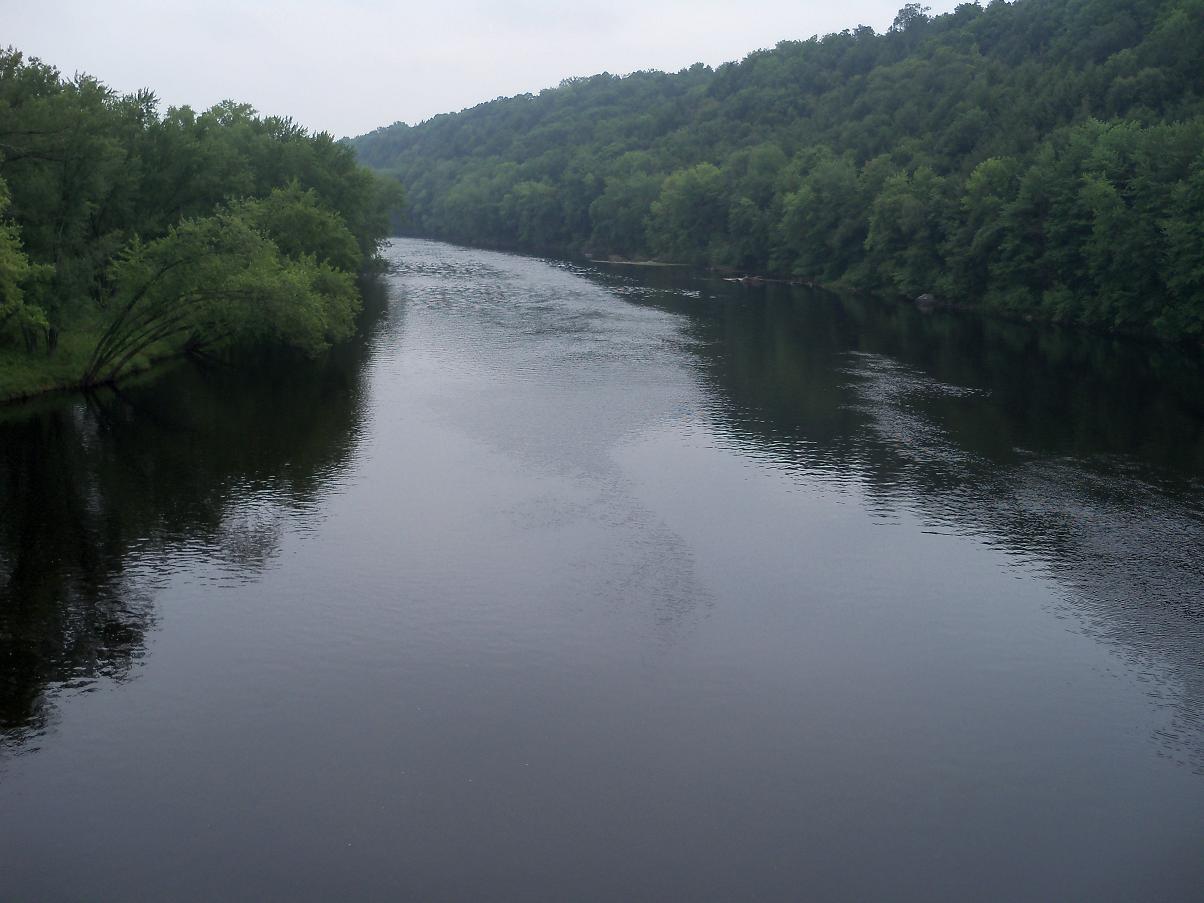


There is a boat launch at a city park in Merril. It is sweltering again, so I wade out into the river to cool off. There are hordes of crayfish around the launch, in a few inches of water. Great sign. Crayfish are the main food for SM bass. The water here is much cooler than the Mississippi at Winona. The river is surprisingly shallow, must walk way out near the middle till it gets deep enough to swim. Feels great to wash the sweat off. I talk to a local in the park. He says there are so many crayfish because the bass will not eat them. They are an invasive species of crayfish, which have outcompeted and all but eliminated the native species. Bass do not eat the new crayfish. Great. Spend 500 million years of evolution inventing the world's most perfect crayfish predator (SM bass), and then corrupt its habitat by introducing another species it will not eat.
The river looks like a piece of cake here. I can run this no problem. I decide to look for a campsite upstream. On the way I pass wild turkeys beside the road.

I find a pretty little county park. Free camping with a boat launch.


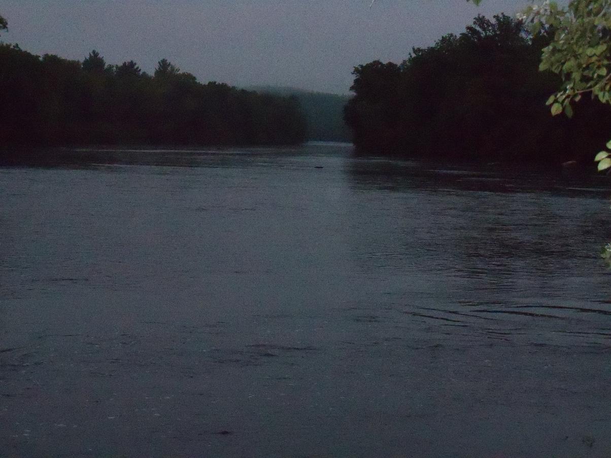
The river looks wide and deep. It is hot and humid. So much moisture in the air things get blurry in the evening. Never see anything like this in Oregon or Van Isle.

Aug 21

I awake before dawn, exited to get out on the river. At the first grey of light I check the boat. Is it still floating? No. I am amazed. The boat, which was floating and tied off to a tree last nite, is sitting high and dry. In Wisconsin they turn “working” the rivers off at night, when the power from the dams is not needed. The river has dropped over a foot. I will have to drag the boat over rocks and gravel to get it into the water. I go to the outhouse, and have a donut in my car, pondering a plan. By the time I get out of the car the current in the river has increased, and my boat is surrounded by water.

I put on gumboots and wade the bank, heading upstream, casting with a #4 Mepps Spinner. Even in the deepest looking spots I hang up on the bottom. This river is incredibly shallow. I could probably wade all the way across it when the water is drawn down. The waters here are stained a dark orange/brown color, from tannins and iron. You can only see about 15" down. No possible way to see a rock before you hit it with your prop.

The rivers here are very changed from since the days when only native peoples lived here. Great log drives, perhaps the greatest in the history of the world, sent millions of sawlogs down these rivers in the 1800s. They rasped the channels out, like taking a router to a cabinet joint. Ground down the high spots, widened out the narrow spots. It would be fascinating to ponder what the hydrology would have been like here prior to the logging and the dams.
The dams stop the migration of sediments, which drop out to the bottom of the reservoirs. They moderate flow levels, so the peak floods do not scour deep holes in the river bed. The rivers here are different from the western rivers I am used to. Much shallower. It would have been a disaster to launch here. I would almost certainly have either smashed a prop on a rock ($200), done more serious damage to the OB leg, or gone downstream and not been able to get back at all. It is madness to even think about taking the Bullship out on this river. If only there was a load out at Brokaw, on the stretch I wanted to fish. Easy river to navigate going downstream, impossible upstream.
I sit in the car and write up my blog, listening to the Awful Polka Music Station on the radio. Then load the boat back on the trailer, and leave without even going out on the river at all. Huge disappointment, after such high expectations last nite.
I drive upstream to Grandfather Falls generating station. In this area the Wisconsin River cuts thru steeply tilted bedrock for about a mile. Used to be big boiling rapids and real waterfalls here, but now the main flow is channeled thru dams and penstocks that feed this hydro plant.


The bitty snake must be having a bad day. He is probably upset cuz I kicked him. He keeps buzzing his tail, even tho there is no sound. Too tiny to have rattles yet? I place my coffee cup near him so I can have something for scale in the picture, and he tries to bite my hand. When I lean in to try to get a closeup he lunges at the camera. When I am done taking pics I try to retrieve my coffee cup, but he won't let me near it. Keeps snapping and lunging at my hand, and shaking his tail furiously. I leave the cup there. When I get back he is gone, along with his bad attitude, and I get my cup back. I try fishing from shore, but it is very shallow.
My poison ivy is healing. My last pus blister is disappearing today. Nothing left but scabs and scar tissue, and one big open sore on my left leg. It will not heal, because I keep getting it wet swimming or keep scraping the scab off by accident. Cannot get my left leg wet. Must keep let the open flesh dry. But my first cast with the #4 Mepps spinner I bought the other day results in a huge snarl, and the lure sinks in among the rocks. I try to tiptoe out on the rocks to get the lure back, but slip in the water. My open sore gets wet again. I cannot keep doing this. Must find a place where I can relax, and let my body drive the evil ivy poison out of me. On the way back up to the car there is a much larger snake sunning itself in the road. Same color pattern, but about 2.5 feet long and 2” thick. It slithers off into the bushes before I can take a pic or see if it has a rattle or not. I do not feel like chasing it thru the bushes to get a better look.
About a mile above the generating plant is another dam. Here most of the river is forced out of the old main channel that went down the falls. An old side channel has been diked off to form a flowage.


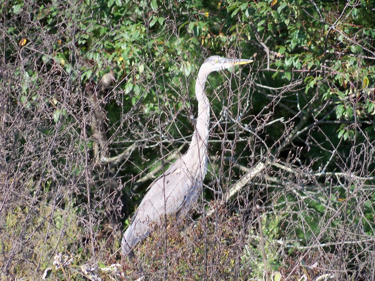
I buy some supplies, head back and launch the Bullship. Head down to the dam, where the main flow is diverted under a bridge into an old side channel. I can barely fit my boat under the bridge. The old side channel is confined by a dike with a road on top. Perfect campsite. And there may even be some fish to be caught. A heron sails in to check me out. I am competition for his fishing spots. Normally a very skittish bird, this one flies right into my camp, checks me out, takes a big crap, and flies away.


I explore the old remant channel, where the entire river used to crash over Grandfather Falls.


Was this fish named after Dieudonné Sylvain Guy Tancrède de Dolomieu, the French geologist whose name was used to identify the rock dolomite?

The bass are very dark here, colored deep rusty brown like the water they live in.
Over the next 45 minutes I get 5 more hits, including some bigger fish. All get off. Rusty hooks! But it was a nice evening bite. I head back to camp, make a campfire and drink root beer and whiskey in celebration.

Aug 22
Wake in the pre-dawn fog. Incredible humidity here. The grass and weeds that were dry the evening before are soaking wet. Every surface is covered in huge drops of water. I tap a depression in the plastic tote bag, 1 ft x 2 ft surface area, and collect nearly a full coffee cup of condensation. I head across to where I was getting bites last nite. There is current along there again and too much weed drifting along with it to retrieve a lure thru. Head back across to the shore I am camping on, and catch a few SMs near the end of the channel.

I go up under the bridge and get a few more small fish. All SM. Just above the bridge is a fishy looking side channel, with a huge hornets nest hanging at the entrance. I get 3 surface hits on the rap from big fish. Miss them all. Need sharper hooks!


I head back into Tomahawk, past an abandoned house. Handyman special.

First thing I do back in camp is jump right in for a swim. A foot under the surface the water is much cooler. Spend the entire afternoon working on my fishing gear, and recovering from the poison ivy. No question now – I am getting well again.
I head back out in the evening. My gear is ready. My hooks are sharp. I am going to try a new area downstream from the boat launch. First I will try trolling a shad rap under the bridge. On the bridge (which is gated off for foot traffic only) a couple have set up white linen table. Dinner and wine in the sunset. This is how they live in Wisconsin.


I get up to my spot. There is another boat about ¼ mile upstream, coming down. May be fishing for bass or for walleyes – I cannot tell. I cruise in to shore and stake out my turf. Make a practice cast with the rap, and then throw it out by some lily pads. I look up to check the other boat, and when I look back the rap is gone in a big swirl. I am hooked into a big bass. After a long fight it gets away in the pads. I make another cast. One twitch and slam! Another surface hit. I catch a nice little SM. I move out to a couple little reedy islets and catch a beauty about 2 ½ lbs. This is very close with the LM I caught on a frog on the Mississippi for the honor of biggest fish of the trip so far. So I quickly speed over to the other boat and get them to take my pic.


7 hits last nite. 13 this morning. Now 3 hits in 10 minutes, and I am just getting into the happy hour when the bite got hot yesterday. The evening is perfect. I am on fire. I have it wired. I have the right lure at the right time, in the right spot, with the right mojo. In the other boat are 3 walleye fishermen. They have been dragging worms on the bottom, and have only caught 1 fish between them. I have pulled in right in front of them and got into 3 nice fish in minutes. I am no longer the goofy tourist. I am THE GUY WHO KNOWS WHERE THE FISH ARE AND HOW TO CATCH THEM. The lowly wormchuckers are amazed at my bass fishing prowess. I am amazed at my bass fishing prowess. I will lay a hurting on the wily bass this evening, and get into some trophy class fish. I can feel it coming.
I fish further down the shore where I started – superb looking bass habitat. Then back out to the reed islets, back to hornets nest slough where I missed 3 big fish this morning, back to the narrows below the bridge. I fish until it is too dark to continue. I never get another bite. Go figure.
In the afternoon I ran all around the flowage, checking depths with my sounder. I am crossing the lake above the dam, at the deepest part of the lake. 30 ft. Idling along when all of a sudden - ka-chonk! ka-chonk! I have hit a rock. Luckily there is only minor damage to my prop.


If I hit a rock like this at high speed I could knock a blade right off. ($200 for a new prop). Or smash the leg on my motor, which would be an expense greater than the total I have spent on this entire trip so far. Must be careful speeding around on these dark waters I am unfamiliar with.
I head back to camp humbled, shamed and defeated. My bass mojo is shattered. Why did I come to this crappy spot anyway? A nice place to camp, but I must get down to the Merril > Brokaw reach where the big fish are lurking.
Aug 23
I go out early and fish the dawn bite. I try all places where I caught fish before. I do not get a single bite on the rap. One good hit on hula popper. Must get out of here. Go somewhere else and find my mojo.
I break camp.


I will miss it here. A very peaceful spot. My poison ivy scars are healing, and I have no more pus blisters. I drive down to Brokaw, and I find the mystery boat launch. How could I have missed it. Just drive down the industrial road past the semitrailer truck storage, over the RR tracks, past the tank cars down the gravel road till you turn left just before the No Trespassing sign.

YES! I can and will get out on the river here. I drive back up to Merrill and rent a motel room at Super 8. I will download pics, work on my blog, swim in the pool and shower. And prep for the fishing trip I have been thinking about for a couple years.
I have just completed an all-niter at the motel. This blogging is worse than cramming for exams in college. Have spent 18 hrs straight downloading pics and updating the blog. Only 2 hrs sleep. I have found a taxi who will pick me up in Brokaw. I will launch the Bullship in Merrill, quickly drive the Volvo down to Brokaw, and get the taxi to take me back to the boat. Will have camping and fishing gear along. If the fishing is good I may spend a couple days, or months, on the river before I post again to the blog...
Try getting a mosquito net tent at an army surpls store. Rig with oars or long sticks.
ReplyDeleteWhat is the rocket like item next to the volvo near Gillette?
I like the Snake Riv. pics esp.
have fun, frances
Stay at my place in Chicago, if you like.
ReplyDeleteYou'll remember me from Afterglow Lake in Phelps.
I don't particularly care for posting my telephone number, but you can get it from Barb,...if you don't already have it.
Ken