"A man has got to believe in something. I believe.......I will go fishing."
Henry David Thoreau
Wautaga
Oct 4
Henry David Thoreau
Wautaga
Oct 4
I take Hwy 46 SW out of Columbus. On the edge of town is a historical marker. At the turn of the 19th century there were still native people living here. But not for long.

I notice that there is an old cemetery beside the road. Very old. Marker stones are tilted at crazy angles.


Many graves are from the Civil War period. Some of these graves are likely soldiers killed during that war.


Many stones are so old the text is illegible.There is no name for the cemetery, no parking lot, no visible signs of management.

The forest is creeping in around the edges.

Broken and nameless ancient grave stones are turfed into the weeds at the forest edge.


As soon as I get away from town I leave the hwy and turn down tiny little roads, heading generally S, and E if I cannot go S. Lots of forest here, and sawmills seem to be a large part of the economy. Little mom & pop mills like you never see any more in the west.


I stop at one and look around. The owner says they are cutting mostly wood for pallets.

They have some nice hardwood logs ready to cut.

This is a headrig mill, seldom seen any more cuz they waste so much wood as sawdust.

Getting near the Ohio River now, land getting flatter, stream gradient is lower. So the streams are getting muddier and slower. Out of the SM belt now. No SM would want to live in this water.

I end up driving down a gravel road in the middle of nowhere. Surrounded by big hardwood forest. No houses, no people around, but No Trespassing signs everywhere.

Streams are almost stagnant now. Minimal gradient. Catfish water. Maybe a few LM here, but not suitable for SM.

Lots of floating duckweed on the surface.


Some are trampled by cows. Yuck.

I cross the Muscatatuck, a river I have never heard of.

Approaching Louisville now. Strip malls and traffic, so I hop on the freeway. At a rest stop is a sign about the Falls of the Ohio.

I never knew there were falls on the Ohio River. Poor cartography leads me to think the state park is on the Ky side of the river. Should have had a pointer arrow in this map.

There is a big boulder full of fossils on the rest stop lawn.

So I drive across the Ohio R, fight thru an hour of downtown Louisville traffic, only to find I must go back to the Ind side.

I never knew there were falls on the Ohio River. Poor cartography leads me to think the state park is on the Ky side of the river. Should have had a pointer arrow in this map.


I must find a bridge and drive back across to the other side.


Here is what the falls looked like before they built the dam here.

Unreal amount of water pouring out of the base of the dam. Looks like there is no hyrdo generation here.

There is a wall of water about 8 ft above the level of the river. Do not want to take the Bullship near here. But the heron does not seem to mind.

Huge RR bridge here, made out of limestone.

The museum is on a bluff overlooking the fossil beds.


Charles Darwin was a divinity student. Planning to become a Christian parson until he saw fossils that he could not fit in with the doctrine he had been taught.


Used to be a big shallow ocean over what is now the US midwest. The Appalachians were above water but the rest was under. There was a giant coral bed along the W side of the mountain coast, much like the Great Barrier Reef in Austraila now. After millions of years the coral beds were converted into limestone. This limestone belt runs from here NW towards N Central Ind. This is the same limestone bed that creates the gradient and water quality for the good SM streams in Ind. Sugar Creek, W Fork White R, Blue R, Flatrock R - all run over this limestone. Do not find much other good SM habitat in Ind. So in a sense, when you are fishing SMs in Sugar Creek you are fishing over the shells of the tiny ancient corals. Same limestone bed I am standing on here, same bed that created the falls.
There were some big fish here, preserved in the rocks.


The native people here were sportsmen. They practiced catch-and-release fishing. You can tell because they used only barbless hooks.

The city of Loiusville was named after King Louis XVI. Clarksville, Ind, on the opposite bank of the river, was named after George Rogers Clark.

GW was the older brother of William Clark who teamed up with King Louis XVI on the great Louis & Clark expedition. The historical markers here repeat the commonly held conspiracy theory that the king was executed by guillotine during the French revolution. In fact, he escaped to the US, made his way up the Ohio R, and met up witih GW's brother William. The 2 of them then partnered to lead the famous Louis & Clark Corps of Discovery expedition across the west. I have taken the liberty to correct this inaccuracy in their sign.

The city of Loiusville was named after King Louis XVI. Clarksville, Ind, on the opposite bank of the river, was named after George Rogers Clark.


(Note: the king later retired to a resort at Moose Lake in N Wisconsin.)
The expedition was organized here.


Used to be lots of buffalo here, gone now.

Used to be lots of passenger pigeons too, gone now.

Then back to Louisville, where they have a White Castle burger stand. Started in Chicago long before McDonalds. Their burgers used to cost 5 cents when I was a kid. Not any more, but they still taste just as greasy.

I get lost trying to find a way out of town. Heading SE, I find the Fort Knox is in the other direction, so I turn off to find Hwy 31 thru Radcliff. Everyone knows about the gold depository, but few people are aware that Fort Knox is home of the US Army Armor School, where they teach tank drivers how to invade Iraq. My dad was a tank captain in WWII, drafted during the Korean War and stationed here to train new tank drivers for the new war. Had to move the family here when I was 2 yrs old. I lived here for a few years, but I was too young to remember.

I get lost trying to find a way out of town. Heading SE, I find the Fort Knox is in the other direction, so I turn off to find Hwy 31 thru Radcliff. Everyone knows about the gold depository, but few people are aware that Fort Knox is home of the US Army Armor School, where they teach tank drivers how to invade Iraq. My dad was a tank captain in WWII, drafted during the Korean War and stationed here to train new tank drivers for the new war. Had to move the family here when I was 2 yrs old. I lived here for a few years, but I was too young to remember.
I make it to the gate at Fort Knox. Take a pic of the Bullship next to the big tank at the gate.

Then walk up onto the berm and snap off a shot of the gold vault Yhe MPs at the gate start yelling at me. Nobody is allowed to take pics of the gold vault. So if you are viewing this blog, DO NOT VIEW THE FOLLOWING IMAGE. If you look at this picture, black helicopters will land on your lawn in the middle of the nite, and you will be taken away and put on an executive jet that will render you to a country where they don't mind engaging in a little bit of torture.


Then head S to Elizabethtown, turn SE onto Hwy 270, heading towards the Cumberland River. I sleep in a Wal Mart lot in Campbellsville.
Oct 4
Get up late. Have breakfast in Campbellsville. Days are still nice but the nites are getting colder now. Fog in the morning.makes the pastoral scene look really pretty.


Head down Hwy 55 over the Green River, a musky stream. A huge fish rolls just as I am taking this pic. A ski having breakfast.


Head down Hwy 55 over the Green River, a musky stream. A huge fish rolls just as I am taking this pic. A ski having breakfast.

I drive up to the Green Lake reservoir, a typically ginormous TVA reservoir. Fishing in this kind of water does not interest me. Not going to buy a Ky license, so I keep on driving.

I come upon a new plant, one that I have heard of before but never seen. I think this is kudzu, an invasive species, imported from it native homeland in Japan, and now swarming over the SE states.

Nothing stops it. Kudzu will climb right up and over anything in its path.


Fascinating culture here. Penetrating deep into the heart of the Baptist taliban now. Radio has 3 stations of hell raising preachers, 2 stations of gospel music, and 1 of generic right wing Rush Limbaugh shock jock rant radio.
Obsessed with the hereafter around here. Had a problem in the 1950s with communists taking taking the place over, but got rid of them. Not having as much success with the kudzu. Support homeland secutiry and the crusade against Islam. Happy to sacrifice their sons & daughters, bankrupt their country, in order to bomb helpless people on the other side of the world. But their own homeland is getting taken over by a foreign invader from Asia, right before their eyes, and they couldn't care less.
I find the Cincinnati Reds baseball playoff game on the radio later. 2 of their big sponsors are the Anti Abortion League and the Creationist Museum. Ironically, this museum is on the Ohio R, just 75 miles upstream from the big fossil beds in Louisville. Wish I had time to go and see this place. Wonder what they have to say about the weird stuff in the rocks along the river?
Soon I arrive at gigantic Cumberland Lake, formed by the Wolf Creek dam on the Cumberland R.


All limestone here again.

This is a very big lake. Too big and artificial for me to have any interest in fishing.

The dam is leaking bad. They are afraid she might blow, which would cause a flood that might take out other big dams downstream. Chain reaction. There is a massive engineering project underway to stabilize the dam. Drilling down into the earthfill section and pumping grout in everywhere.


The kudzu vine is taking over large parts of the country here. Swallows up everything in its path. Swarms over telephone poles, old cars, trees, anything. Covers the native veg over so there is no light getting thru. Kills everything in its parth. Entire little valleys are sometimes completely swarmed over. This is an invasive with an attitude. Glad we do not have any in OR – yet.


Big power plant here.

Below the dam is the world's largest trout hatchery.

The big trout are for display only. They fly eggs in from all over the country and raise native fish for replanting in home waters. I know I could catch something if I fished here.

USFW has a big visitor center and museum here.

USFW has a big visitor center and museum here.

Good butterfly collection, always the sign of a good museum.

Any regular followers of this blog should recognize some of these.


Nice place here, no wonder there is such a crowd attending.

Inside they have better aquariums than at Shedd Aq in Chicago.


Longnose gar. These guys live in Sugar Creek, Ind.


Here is what happens to a trout that sits in the same cubicle and eats pellets all day every day. Looks like the people you see at Wal Mart with fully loaded carts of groceries.

There used to be free flowing rivers here before the TVA dammed them. Lots of weird little fish species that lived nowhere else. Many are struggling to survive now.


The parking lot is full of people when I get there just as they are opening. Never saw so many people at a little museum. Turns out I am the only tourist there. Everybody else is here to attend a pre-bid meeting for contracts to do more work on the dam. I flash my VISA card, ask if I can be allowed to sit in on the meeting and maybe bid on a contract, but they say no.

This place is the promised land for lawnmower drivers. I would kill to get this job. Rocky King, eat your heart out!


Then I head across the dam and around the S side of Cumberland Lake on Hwy 90. Cross a high bridge over a creek. These limestone slab pools obviously are home to native SM.

Heading E now, thru hill country.

The wooly bears come in designer colors here.


Hopeless to try to predict the weather according to wooly bears around here.


When they are disturbed, wolly bears roll up into a wooly ball. If it is windy and they are on pavement the wind will rool them along like little fuzzy balls until they roll into the grass on the other side.

On thru the little town of Monticello, where they have a local history museum. There is a realy nice elderly lady who runs the museum. She is embarrssed because here hands shake when she holds the camera. Has to take a bunch of pics of me in the stagecoach, cuz most come out blurry. I am just glad she has the energy to keep this place open for people like me who wander by. This was the last active Pony Express stage W of the Mississppi.

They have dioramas of the Battle of Mill Springs, fought nearby in 1862. She has light pointers that follow on the diorama a recorded documentary about the battle.


The Confederates valued Mill Springs. Very important – a ford across the Cumberland R, ag land all around to provide meat & grain, and a mill to grind food for the troops. This was the eastern flank of the rebel defensive line across the Ky. Commanded by Gen Felix Zolicoffer. When the union troops attacked Zolicoffer rode into the fray, thought his troops were confused, shooting in the wrong direction. Ordered them to turn around and shoot the other way.

Turned out it was the Big Z who was confused. In the madness of battle he had ridden right into the union lines. The troops were not shooting in the wrong direction – they were not hist troops. Shot him dead on the spot. First general to fall in the Civil War. The big tree where he was shot was still standing until a storm blew it down a few years ago.

History is thick in the air here, like the smell of the stubble in the new mown corn fields. First oil well in the US was not Titusville, PA, but rather here in Wayne Co. But they didn't know what to do with it, had no market for it, so never developed it at the time.

Dick Burnett was a blind banjo picker here, used to sit in the square downtown pickin & singin. He is the author of the song "I Am A Man of Constant Sorrow", performed by the Soggy Bottom Boys in the film O Brother Where Art Thou?

They have a very nice cemetery here.

Then I head E to Mill Springs. A critical Civil War battler took place here.


The house they used as headquarters is still standing.

The mill here is the largest overshoot water wheel ever built. Still runs on weekends for the tourists.


Everything was driven by belts.

The giant timbers are not sawn lumber, they were squared with an axe.


Continue E on Hwy 90 to Burnside, at the top end of Cumberland Lake. There is a beautiful overlook up on top of a ridge. Built by the WPA during the depression. Unfortunately they never thought far enough into the future to anticipate all the traffic we have today. Did not include any area for parking, and it is on top a ridge so nobody has ever built any parking for it. All but abandoned now.


Trees are growing up now, so you can barely see out from the scenic overlook.

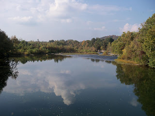
I am upstream from Cumberland Lake now, and the river is a river again. Long slow pools here.

Then follow the Cumberland R up, head E on to Hwy 25 to Corbin.

Getting into real mountains now. These must be the Appalachians.

Hwy 26 to Williamsburg, and Hwy 92 E to Pineville. Back on Hwy 25 to Middlesboro. Evening now. The hwy crosses over into Virginia.

Kudzu here.


I have arrived at the famous Cumberland Gap, the gateway from the E to Ky and TN.


I drive up to the overlook and hike up to the top of the mountain. Sedimentary rock here, but not tilted and overthrust like in the Rockies. Still bedded horizontally here.

Far below me are the Cumberland, Powell, and Clinch Rivers.

Far below me are the Cumberland, Powell, and Clinch Rivers.


The 3 states of KY, TN, and VA meet somewhere down below.


The union troops hauled cannons all the way up here to defend the Cumberland Gap during the Civil War.

Then I head thru the same tunnel Daniel Boone used when he came to explore Kentucky.

I head E in the dark along Hwy 58, cross the Powell and Clinch rivers in the dark. They are heading SW out of the mountains, but are not tribs to the Cumberland. Instead they will flow into the Tennessee River on its long swing S thru Alabama.
I am going to the tri cities of Bristol, Kingsport, and Johnson City TN. My Uncle Anton was a chemical engineer, got transferred to J City when I was a kid. We went down to visit one summer, and my dad and I caught RBs and browns in the cold waters of the Watauga and S Holston Rivers. Tailwater fisheries beneath big reservoirs. The Basstravaganza tour will take a slight diversion, and expand its mission statement to include trout. I sleep in the car beside a little road outside of Bristol, thinking about the time I was here. Over 40 years have passed. Wish I still had my neoprene waders.
Oct 5
I drive into Bristol, find a cafe with internet connection. Spend 2 hrs looking at the area in Google Earth, seeking boat launches. I meet a retired local guy who gives me lots of tips about fishing around here. The S Holston and Watauga rivers both flow from the east thru this area. Both dammed by TVA into giant reservoirs which release cold clear water that trout love. Never used to be any cold water here, and never used to be any trout in the valley bottoms. I drive SE along tiny roads until I find the S Holston. These TVA rivers are either on or off. Either no flow from the dam, so the river is all slack water, or giant flows when they are generating, so the river is flooded up into the trees. The S Holston is running very high and fast.


No way I am going to run this water in the Bullship.

More disturbing, everything is private here. No public access. No way to even put the Bullship into these rivers if I wanted to.


No way I am going to run this water in the Bullship.

More disturbing, everything is private here. No public access. No way to even put the Bullship into these rivers if I wanted to.
The Watauga & S Holston rivers merge into the waters of Boone Lake. Tiny lake by TVA standards, but still probably 20 times the size of Emigrant Lake in Ashland OR. Boone Lake is a giant water park surrounded by 3 cities and ½ million people. Trophy homes surround the shoreline. The lake is down a few feet now. TVA draws it down in winter.

Question mark butterfly beside the road here. Looks like a dead leaf with its wings closed. Invisible until it spreads it wings.


I find a number of boat launches on the lake. Spend the entire day driving around and looking at opportunities. Boone Lake dam empties directly into Lake Patrick Henry, which empties into the Holston R that flows W. I find a little tackle shop, where the operator confirms the gossip I heard from the guy in the coffee shop. The tailwater below Boone Lake is supposed to be hot for giant trout when they are releasing water. The inlet arms of Boone Lake are supposed to be hot for striped bass. Stripers are not native to here. An anadromous fish native all along the Atlantic coast. Can be over 50 lbs in here.
Looking up to Boone Lake tailwater:


At the boat launch there are some deer browsing. 3 deer in the next pic, but you can't see them. They know I am there, so they are blending in with the scenery.


A bird flies in and sits on a wire. I am not good about birds. I think this is a shrike. Brutal heartless creature. Had a live butterfly in its beak when it landed, swallowed it before I could snap off a pic. I jump out of the car screaming Murderer!!! but it pays no attention.

The monster houses are fighting the old tabacco barns for habitat around here now.


Back into J City now. They have a neat old train here.


They still use this train in secret undercover drug investigations.

By evening I have found lots of prospects on S Holston/Boone Lake, so I go looking for the Watauga. Just before dark I end up at the same pool where my dad and I fished years ago. There is a canoe launch site here, built by a float trip company. I know I can get the Bullship in the water here. I sleep at the launch site, remembering the days long ago when my dad and I waded this pool and caught lots of planter RB and browns in rooster tail spinners. There were always huge fish rising in the deep part of the pool along the far bank. We could not reach these fish by wading. I have been waiting 40 years to get a crack at them. And tomorrow morn it is going to happen.
Oct 6
Before dawn I back the trailer over the grass edge and slide the Bullship into the Watauga.
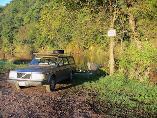
First time it has been in the water since the Rock R in Wis. Seems like ages ago.
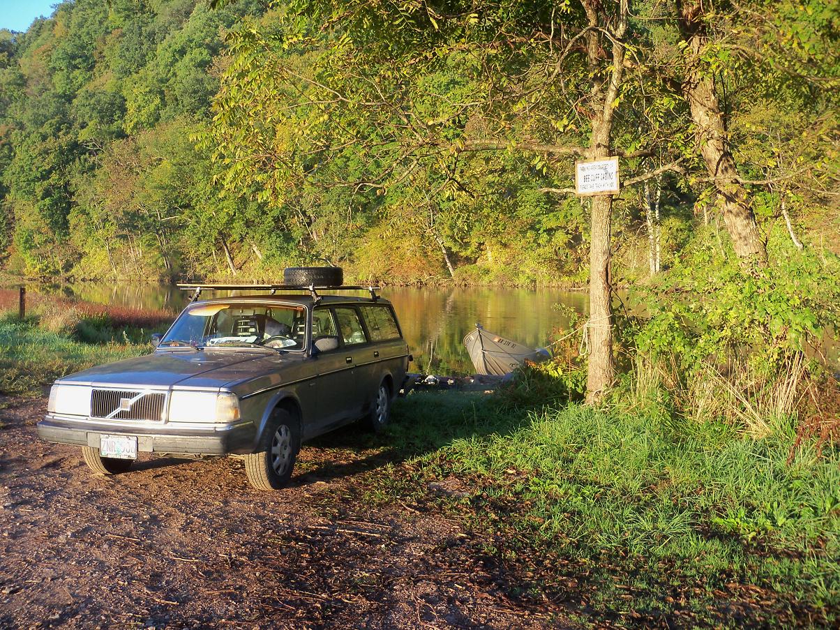
First time it has been in the water since the Rock R in Wis. Seems like ages ago.

Within moments I am afloat on the river, watching trout rise on the Watauga in front of me.


Huge pool here about a 1/2 mile long.


The water is crystal clear. Substrate is about an even 1/3 mix of rocks, gravel and beer cans. The private property is immaculate around here. At any slightly public place there is garbage everywhere. Garrett Hardin wrote a famous essay about this called "The Tragedy of the Commons".

I drift slowly down the current to the tailout throwing the roostertail everywhere. No bites. The fish are here, spooking out beneath me, just not as stupid as they were years ago. The Watauga is a world famous trout stream now. Gets a lot of pounding from guided fishermen. Cannot catch anything so I motor silently up along the deep bank, where driftwood logs are stacked up. I can see 15 ft down, see lots of trout scurry out when the boat goes over them. They say you need to fish here when the dam is running and the current is high. I motor all the way up under the bridge to the top of the pool, drift back down throwing spinner and rap. No bites today. When I get back down there is a cop or wildlife officer in a pickup parked next to my car. Nobody has ever seen a boat like the Bullship in this pool before. He probably can't believe his eyes. But I am not breaking any laws. He leaves, and later I head back to the car. Must tie the bow rope onto the car and pull the Bullship up onto the grass with the Volvo. Then I load it onto the trailer and take off.
Beside the river is a flower patch with butterflies.

And cloudless sulfurs feeding.

And cloudless sulfurs feeding.


Fritillary here, sp unknown.


I head upriver. There is a small regulating reservoir called Wilbur Lake between here and Watauga Lake.
 There is a place below Wilbur dam where I could launch the Bullship.

I think about launching here, and drifting down to the big pool where I just fished. Then I could walk back up to the car. But I am not sure about the water here. What if there are bad rapids in between? I could not go down, and maybe not get back up thru the shallow rapids. I bail on this plan. Good that I did, for I learn later that there is a 5 ft waterfall just downstream. Would have been disaster if I had gone down in the Bullship.


I head upriver. There is a small regulating reservoir called Wilbur Lake between here and Watauga Lake.


I think about launching here, and drifting down to the big pool where I just fished. Then I could walk back up to the car. But I am not sure about the water here. What if there are bad rapids in between? I could not go down, and maybe not get back up thru the shallow rapids. I bail on this plan. Good that I did, for I learn later that there is a 5 ft waterfall just downstream. Would have been disaster if I had gone down in the Bullship.
Near the Watauga Dam is a parking lot with a bed of petunias.

There are a bunch of blue swallowtails hanging around, sucking nectar out of the flowers. Flashing their metallic blue hindiwngs.

A southern butterfly. Seen a few already, but not close up. Unlike most butterflies they do not seem to ever land and sit on the flowers they feed on. Just keep hovering while they stick their proboscis feeding tubes down in to reach the nectar. I take a million pics, but don't get any good ones, They just won't sit still.


Also some clouded sulfurs here.

I spend the afternoon driving around looking for internet cafes and places where I can have a meal and watch the baseball playoffs on TV. Find a few places in J City. Tonite I will go to Hooters for the first time ever. Giants vs Braves in game 1 of the playoffs. Tim Lincecum pitching.
Fundamentalist religion is huge here. Biggest industry in town. Must be kind of like Saudi Arabia or Afghanistan.

Never far from anyone's mind.

Back in J City, abandoned factory behind and abandoned megamall store. Sign of the times. The "current economic downturn".


I come to the historical site at Sycamore Shoals on the Watauga.

The Wautauga Association began here. The sign describes it as “democratic and egalitarian” - what the H happened to bend it into genocide for the natives and slavery for the blacks? They have a reconstruction of the old fort.

Not all the Cherokee were happy to give up their ancestral lands. Conflict ensued.

One of the major and often understated motives for the Revolutinoary War was anger that the British were trying to maintain the agreement they had made with the natives to prevent colonial expansion across the Appalachians. Cherokee leaders had been to England and back, and had singed agreement to this end. The colonists (patriots as they are refered to around here - what, were the British soldiers not patriotic to their country as well?) wanted the freedom to exterminate the natives or kick them off their land.

I walk down to the shoals. RV park on the far bank. The Overmountain Men marshaled here before setting out on the decisive campaign the led to Cornwallis' defeat, and victory for the US Revolutionary War. They stayed at the RV park before setting out to defeat the British.

I walk down to the shoals. RV park on the far bank. The Overmountain Men marshaled here before setting out on the decisive campaign the led to Cornwallis' defeat, and victory for the US Revolutionary War. They stayed at the RV park before setting out to defeat the British.

Just like upstream, the river is full of garbage here. Watauga is an old Cherokee word that means “river of garbage”.

Then I head back out to do some fishing. I want to fish the Boone Lake tailout for trout, but there is no flow this afternoon, so I set out onto Boone Lake instead, from the launch site near the dam. This lake has 2 long arms, and many smaller arms. I head up the Watauga R arm. The lake is drawn down about 10 ft. Shoreline is rocky. Almost completely surrounded by giant trophy homes. I locate some good looking rock points and mid lake rock piles. Will fish these on the way back. Then head up into a long bay. So much great looking bass habitat – where to start? I find a shady inlet and throw the yum worm all around. No bites. There is a big bass boat throwing a cast net. Catching shad to use as bait for stripers. I realize that I left my camera behind in the car. More important, a crisis is brewing. I was eating junk food and coffee while driving around J City. Now it wants out. I am 3 miles up from the boat launch. Not surrounded by forest like in Wisconsin. Cannot go up on some millionaire's lawn and take a crap right in front of their trophy home. Brings back horrific memories of a similar incident on Shawnigan Lake with Miles S some years ago.
No choice, I must speed back to the boat launch where there are restrooms. Halfway back I see what looks like a park on shore. But it is too shallow to get near. Wasted valuable time checking it out. Getting serious now. I speed back to the launch. No outhouse here. Need to drive over to the viewpoint near the dam. I make it to the parking lot just in time. Restrooms are locked. !^%#*!(*(%^ ! Jump back in the car and race over to the visitor center. Big restrooms there. I am running across the lot, tourists looking at me like I am strange, 100 ft away from my goal when crisis turns to tragedy. Cat 7. It is the dreaded coffee diarrhea. Takes me half hour in the restroom to clean up the mess. Wasted the best part of the evening bite. I don't like this lake already. Bad things happen here.
No choice, I must speed back to the boat launch where there are restrooms. Halfway back I see what looks like a park on shore. But it is too shallow to get near. Wasted valuable time checking it out. Getting serious now. I speed back to the launch. No outhouse here. Need to drive over to the viewpoint near the dam. I make it to the parking lot just in time. Restrooms are locked. !^%#*!(*(%^ ! Jump back in the car and race over to the visitor center. Big restrooms there. I am running across the lot, tourists looking at me like I am strange, 100 ft away from my goal when crisis turns to tragedy. Cat 7. It is the dreaded coffee diarrhea. Takes me half hour in the restroom to clean up the mess. Wasted the best part of the evening bite. I don't like this lake already. Bad things happen here.
Head back out. Sun going down now. There are lots of brushpiles placed for fish habitat in the cove at the launch. No bites here on surface lures. So I head out along the shore across from the launch. Throwing a zara spook at rocky points. No bites. There is a marker buoy here. Must be a sunken rockpile under it, so I toss the spook there. It gets crushed. Nice 3 lb LM.

Then head out onto the main lake. Bad place to be throwing a surface lure. All the bass boats on the lake are returning to the launch. So there is a constant rolling swell from their wakes. No way to get a surface hit in all this commotion. I head back in, dejected. Lots of fish in this lake, but not the kind of place I like to fish. At dark there are more boats launching than coming in. Nite fishing is big here.
Need to go into town to watch the BB game. I drive into the big parking lot where the Hooters place is. This should be a hoot. There is another big club there. Empty, closed cuz of "today's economy" - the endless recession. All Obama's fault. The Hooters lot is full. Must be 50 Harleys parked there. Game not started yet. Do I really want to go in this place? On the porch are a bunch of rowdies drinking and being A holes. I wait in my car at a safe distance, watching. Will wait till the game starts before I have to enter this place. Clumps of Harley people start leaving. In groups of 3 and 5 they rev and rumble, then crack open their throttles and spin their tires, burning a cloud of rubber before they peel off into the Tennessee nite, while the crowd on the porch screams out rebel yells. This goes on for a half hour, until there are only a few Harleys left. Then somebody gets into a hot car, stomps on the gas pedal and performs a spectacular NASCAR tire burn. Car not moving, huge cloud of rubber smoke building up in the hot still nite, drunken psychos cheering on the porch. After about 20 seconds – seems like an hour – he finally lets off the pedal and squeals off drunk into the nite. There is a cloud of rubber smoke that covers almost the entire parking lot, like enough to cover a football field. The crowd on the porch is going wild. This is what they do for fun in TN. Daddy must have lots of cash to afford to buy his kid new tires every Saturday nite. Aren't there any cops in this town?
I can handle the cowboys in Wyoming, and the street scene on the S side of Chicago, and the farmers in Ind when the catch me trespassing. This is the first place that really scares me. Lots of people around here are retarded and demented. I do not want to go into this joint. A little ways away is a “sports bar”. I have been to a few of these. Overpriced beer, bad food, loud loud awful awful music. I long for Wisconsin, where there is a neighborhood tavern on every second corner. Real human beings you can have a conversation with. Nothing like that in Tennessee. Totally different culture here. No neighborhoods here, everything is single homogenous Wal Mart culture here.
By the time I get seated I have missed the first batter. Lincecum has given up a leadoff double. What is happening - is Tiny Tim losing it? Not so much. Strikes out the next batter, and the next, and the next. And the next, and the next, and the next. Only gives up 1 more hit, strikes out 14. Complete game shutout. Giants win 1-0. The Freak. One of the great pitching performances in baseball playoff history. Costs me $25 to see it. Worth every penny. I have had a few beers. Don't want to drive, so I sleep in the empty lot of the place that went broke.
Oct 7
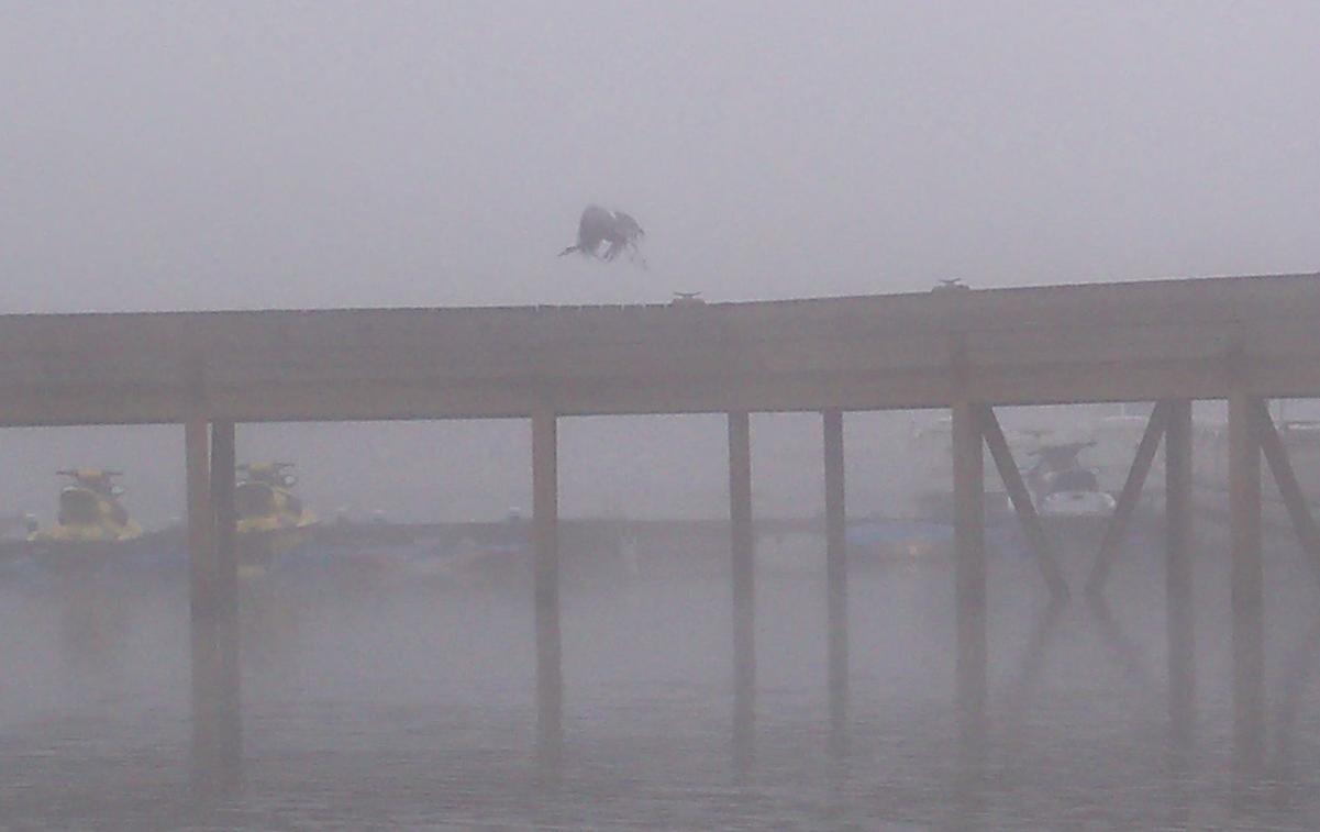
I launch before dawn at Boone Lake. Gonna hit some of those rockpiles I found yesterday before I had to bail and run for the outhouse. Still dark, but lots of bass boats launching already. One guy saw me coming in last nite. Warns me that I am likely to get busted. I have no lites on my boat. Can't be driving around on this madhouse lake without lites. This morn it is pitch fog.

Can't see more than 100 yards. Cannot possibly find the spots I located yesterday. Cannot even see the other shore. Sure to get lost on this big lake if I head out into the fog. All I can do is creep down the shoreline. Can always find my way back by following this shore.

So foggy that I get trapped behind a dock complex that must have space for 400 boats. There is a heron silhouetted in the fog. Just as I snap the shutter it spooks and flies away.


Should be a perfect morn for topwater. I keep throwing the spook. No bites. A few big fish are slurping out in deep water. Stripers. I throw the spook over the rises. No bites. Don't like this lake of trophy homes. I wanted to run miles this morn and check out the whole S Holston Arm, but I can barely creep along. After 2 hours I am bored. Done with this lake. Outahere.

Can't see more than 100 yards. Cannot possibly find the spots I located yesterday. Cannot even see the other shore. Sure to get lost on this big lake if I head out into the fog. All I can do is creep down the shoreline. Can always find my way back by following this shore.


Should be a perfect morn for topwater. I keep throwing the spook. No bites. A few big fish are slurping out in deep water. Stripers. I throw the spook over the rises. No bites. Don't like this lake of trophy homes. I wanted to run miles this morn and check out the whole S Holston Arm, but I can barely creep along. After 2 hours I am bored. Done with this lake. Outahere.
As soon as I load the boat back on the trailer the fog melts away. I take some pics of the dam as I leave.

Under this dam is where I wanted to fish for trophy trout. Don't like this lake, don't like these rivers full of garbage. Don't like this state with no public access to rivers. Gonna forget about the time remaining on my 10 day TN fishing license and blow this scene.

Under this dam is where I wanted to fish for trophy trout. Don't like this lake, don't like these rivers full of garbage. Don't like this state with no public access to rivers. Gonna forget about the time remaining on my 10 day TN fishing license and blow this scene.
I've been round in donkey town, too long, baby, too long.
Checkin out of donkey town, so long, so long, so long...
Off to a new river. Off to THE New River.
The New River is a misnomer. According to the geologists, the New River is the oldest river in the US, 2nd oldest in the world after the Nile. The geology here is folded mountains. The earth's crust was not shattered, with huge slabs driven up on top of each other as in the Rocky Mountains. Tectonic pressure was not as great here so the land just folded up like the pleats in a curtain. The streams flow along the bottom of the folds in the pleats, so they are long and parallel. No space for long tribs to develop coming straight down off the ridges, so there are lots of tiny creeks but few intermediate sizes streams. This is called "trellis" hydrology in the world of geomorphology. Very different from the more normal "dendritic" hydrology which is found in gently sloping landscapes like Indiana or Wisconsin.
http://en.wikipedia.org/wiki/Drainage_system_(geomorphology)
As a result there is nothing like Creek X or Walnut Fork in this part of the world. All big long rivers here running parallel to each other between the ridges of the Appalachians. The Powell, Clinch, Watauga, S Holston.
The New R is an exception. The New R does not run between the mountain ranges, it slices right THRU them. This is why geologists surmise that the New R existed prior to the tectonic uplift that created the mountains. As the Appalachlians were uplifting the New R just kep cutting down thru them. As a result it often blasts head on into angled beds of sedimentary rock, creating spectacular underwater ledges and undercuts. Spectacular, that is, if you are a bass fisherman. The New R is world famous for its SM bass fishery.
I go back into Bristol for gas and then head SE on Hwy 421. Crosses right over the middle of S Holston Lake, a giant TVA reservoir.

Suddenly I am out of the maniac hustlebustle of the tri cities. Climbing up into the mountains.

Suddenly I am out of the maniac hustlebustle of the tri cities. Climbing up into the mountains.
Comma butterflies beside the road here. Different from the question mark, cuz they have no dot under the silver symbol on the underside of the hindwing. Otherwise very similar.

Lucky that this family of butterflies, the Nymphalidae, were all English majors in college and are very good at punctuation, so they can tell their species apart.
Look just like a dead leaf when the wings are closed.
Look just like a dead leaf when the wings are closed.


But flash lots of color when they open.


Then a curious question mark flies in to query the situation.
Expected more 4 lane divided, but all of a sudden I am winding up steep switchbacks in dense forest. Over a mountain range and down the other side. Into a sunny cleared bottomland called Shady Valley and right back up steep hairpins. Steepest grades and tightest turns I have been on yet, including the mountains across BC. Into N Carolina now. Thru the towns of Boone and Deep Gap, where I turn onto the Blue Ridge Parkway. On top of the continental divide here. If I take a pee off the E side of the road here it will run down into the Atlantic Ocean, not down the Mississippi into the Gulf of Mex. Can't resist, so I do.


Expected more 4 lane divided, but all of a sudden I am winding up steep switchbacks in dense forest. Over a mountain range and down the other side. Into a sunny cleared bottomland called Shady Valley and right back up steep hairpins. Steepest grades and tightest turns I have been on yet, including the mountains across BC. Into N Carolina now. Thru the towns of Boone and Deep Gap, where I turn onto the Blue Ridge Parkway. On top of the continental divide here. If I take a pee off the E side of the road here it will run down into the Atlantic Ocean, not down the Mississippi into the Gulf of Mex. Can't resist, so I do.


Remember the old Kingston trio song “Hang Down Your Head Tom Dooley”?

One lookout frames a beautiful scene with an ugly clearcut in the middle.

This kind of logging will lead to erosion in the future.

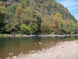
I turn off the parkway into Glendale Springs. Evening now, going downhill. Should be coming to the New River. And there it is. This is the S Fork, up near the headwaters.


Water is shallow, rocky, and clear.

One of the few places left that still has water quality sufficient to harbor the rare hellbender salamander. Skis here too!

Unlike TN, there are parks and access points along the river here in N Car. I head downstream, crossing as many bridges as I can. Getting near the confluence with the N Fork, so I swing W to see it too.

Xmas tree farming is a big industry around here. Like Hollywood starlets, their social worth devalues quickly with age.

These trees do not have long to live.

Don't want to pay for a license here in N Car, so I head downstream into Virginia. Lots of pumpkin fields here.

I find a gas station that sells fishing licenses. Across the road there are latinos loading pumpkins onto trucks.

Don't want to pay for a license here in N Car, so I head downstream into Virginia. Lots of pumpkin fields here.

I find a gas station that sells fishing licenses. Across the road there are latinos loading pumpkins onto trucks.

Pass a town with one of the weirdest names ever here.

So far the river has been shallow and rocky everywhere, but just across the VA border there is a big long pool. A guy is bank fishing here. Says he caught 1 small bass.

The pool is formed by a dam that does not seem to be used any more. Take It Out!

I will launch the Bullship here in the morn, and match wits with the trophy SMs of the New R. I sleep in the car at the launch, ready to do battle with the New R giants tomorrow morn..
Oct 8
I launch before dawn, but too late.

Could have got surface hits 15 minutes ago. Still too dark to see the bottom of the pool beneath me. Throwing the spook, which casts a mile, I get a couple tiny hits. Should be big fish here. Then a crashing eruption. Big fish! It is a New River giant, 19.5”.

Could have got surface hits 15 minutes ago. Still too dark to see the bottom of the pool beneath me. Throwing the spook, which casts a mile, I get a couple tiny hits. Should be big fish here. Then a crashing eruption. Big fish! It is a New River giant, 19.5”.

I expect it will continue this way. Trophy SM every 15 minutes or so. But I only get 3 hits after that, catch one small bass.

The pool is over a mile long. I drift all the way to the end. Superb indian summer morn, fish or none.


But the lower ¾ are all shallow sand & mud, sediment deposited behind the dam. Not much habitat here for SM. I motor back up. Above the launch site and bridge it gets rocky and shallow up to a rapids. No fish there either. Only 1 good zone in this pool, right where I caught the big fish.


But the lower ¾ are all shallow sand & mud, sediment deposited behind the dam. Not much habitat here for SM. I motor back up. Above the launch site and bridge it gets rocky and shallow up to a rapids. No fish there either. Only 1 good zone in this pool, right where I caught the big fish.
Need to get onto Google Earth and check this place out. Saturday again. I made a vow before I left that I would rent a place and take a shower at least once a week, whether I needed it or not. It has been a week, so I go looking for a cheap motel. Drive down to Independence, but they are having their annual fall Color Festival. Town is packed.

I find another boat launch. Tons of them here, just the opposite of TN. The rivers are a public resource here, not private property. Lots of people out on the water here, just the opposite of TN. This place is too shallow for the Bullship. You can see that the river is driving right into sloping limestone layers here. Find shady ledges like these, but a bit deeper, and you will find SM bass.

No motel rooms here. I drive farther on downriver to the town of Galax. Rent 2 nites at a really scabby motel for $75. All I want is a shower and internet connection. Spend the rest of the day getting cleaned up & re-organized. Watching FB games on TV. Leave the boat behind in the evening and go looking for a boat launch near town.
VA is totally the opposite of TN. No public facilities of any kind in TN. Get the govt out of our lives! The lord will provide. In VA there is a free public launch at almost every big pool in the New River. But there are no straight roads here. Cannot take off on a little road and hope to head in any particular direction. Need a live internet connection in the car tuned in to Google Maps here in order to navigate. I spend 2 hrs getting lost trying to find a launch 10 minutes away from town. Go back to the motel and watch the BB and FB games.
Oct 9
I spent hours yesterday looking at the New R in Google earth. The imagery is very clear. This is a very rocky river. You can see bottom almost everywhere in Google Earth. Need to find some deeper water. I can see what looks like a big deep pool at the town of Austinville, about 25 miles downstream. Also see there is a boat launch into it. I leave the motel an hour before dawn, drive E onto the freeway and then turn off to Austinville.
The launch is there all right. I throw out 3 casts in the dark with the spook before disturbing the pool by launching my boat. On the 3rd cast a good fish pounds the spook right in front of me, 20 feet out from the launch. Good sign. I launch and slip upstream quietly with the electric motor. Superb looking bass water. No bites. That is the trouble with world famous fishing streams. They attract world famous guides, who bring hordes of clients using the most sophisticated gear. Mediocre fishermen like me don't have a chance. About ¼ mile up I come to a rapids. Cannot believe the spook has not been hit. I drift back to the car, and have a bite to eat. Then go back out and try a yum worm on one rod and rap on the other.
The worm gets bit right away. Nice fish. 17”.

This pool is huge, goes on forever.


Unbelievable rock ledges appear and disappear out of deep water. No problem finding deep water here. I keep pounding the shady shore with the worm. Get 1 more SM, 12”. A pair of musky fishermen are working the same bank. Throwing soft plastic baits about a foot long. Muskies in VA – who woulda thunkit?
Over a mile down from the launch now, still in the same pool. Another bite. LM this time, about 1 ½ lbs. Didn't know they were in here. Did not get a pic.
I work the tailout hard, no bites.

This is the best single pool I have ever seen for SM. Need to work those deep ledges with worms or grubs. I head back to the motel at noon. Bears FB game should be on, but they are playing Carolina, which is a home team here so the broadcast is blacked out. But I see on my computer that Bears QB throws 4 interceptions, has a QB rating of 6.2. But the Bears win anyway.

This is the best single pool I have ever seen for SM. Need to work those deep ledges with worms or grubs. I head back to the motel at noon. Bears FB game should be on, but they are playing Carolina, which is a home team here so the broadcast is blacked out. But I see on my computer that Bears QB throws 4 interceptions, has a QB rating of 6.2. But the Bears win anyway.
Oct 10
I go back to Austinville early again. As they say in NY, the oily boid gets the woim. Must fish and get back to the motel to shower and check out by 11. Catch 1 SM very early on a buzzbait.

No other bites. A pair of retirees are launching, gonna fish with minnows for walleyes.
I go back to the same pool in the afternoon after checking out of the motel. The walleye fishemen are still there. Have not caught a single eye all day. I pound the deep ledges and shady banks. Stunningly stupendous bass water. No bites. Head up to the top end, inch my way up into the next little pool.

No bites. A guide is taking a client around fishing for skis. Throwing a soft plastic swimbait about a foot and half long. They say they raised 3 fish this morn.
Unidentified fritillary on the bank here.


I cannot get a bite. In the evening I drift the middle section of the pool, throwing the spook over the deep ledges. Catch 1 fish. Bad pic.


No bites. A guide is taking a client around fishing for skis. Throwing a soft plastic swimbait about a foot and half long. They say they raised 3 fish this morn.
Unidentified fritillary on the bank here.


I am insulted. Done with this river. I will go fish somewhere else. Load out after dark and jump back on the freeway to Bristol. Objective #1 for the basstravaganza was to fish Creek X in Indiana. Done. Objective #2 is to find and fish the Nolichucky River. I know I went there when we were visiting my Uncle Anton years ago. Must be near Johnson City. My ex supervisor in Ashland, Jamie N, gave me a CD by the Kronos String quartet playing music by Philip Glass. Very minimalist repetitive music. I like it. Played it over and over at work. During one section my brain keeps repeating “Nolichucky Nolichucky Nolichucky Nolichucky” in time with the music. I cannot stop it. I need to actually touch the waters of this river in order to cleanse my brain. I will head back to the tri cities. Try the outflow from Boone dam for trout if it is running. Then head out in search of the Nolichucky. I find a rest stop on the freeway and sleep there – one of the very few public facilities in this part of the world.
Oct 11
Leave the rest stop at 3 AM. Get to Boone dam at dawn, but they are not running water thru. I drive into J City to the only Starbucks within 6,000,000 miles. Have coffee, download pics, check the internet and email. I find out that the Nolichucky R is only about 20 miles SE of J City. I spend an hour looking at it in Google Earth. Another hour reading websites about the bass fishing there, and on its sister river the French Broad. The Nolichucky comes out of the Appalachian Mountains near the town of Erwin, then winds thru cultivated hill land SE until it merges with the French Broad. Impounded there into a giant TVA reservoir. Supposed to be good SM fishing everywhere.
I head out around noon, get lost trying to follow little hwys. Impossible here. Nothing goes in any one direction. Suddenly I am at the river. My long quest is over. Objective #2 of the basstravaganza is achieved.


Killer SM habitat. But no boat launches.

All private property, no trespassing. I find an RV park, ask if there are any public boat launches. She looks at me like I am asking if there are any martians landing. There is one stretch of 2 lane hwy that runs right along the river. Usually no shoulders on the hwys here. Can't even pull over to look at a map or take a pic. But there are a couple of tiny pullouts here. I squeeze in next to someone who is already fishing.


I sit and watch the river for a while. Big beautiful pool up from here.

Trash along the banks everywhere. Trash all over the pullout edges. He comes in and we talk. He says there is National Forest and better access and better fishing a few miles upstream. I go looking, get turned around the wrong direction. Try to get down into a pool along the hwy. Trying to be careful, but my new $10 waders catch on a twig and rip on the way down to the river. Never even made it into the water, and ruined.

Trash along the banks everywhere. Trash all over the pullout edges. He comes in and we talk. He says there is National Forest and better access and better fishing a few miles upstream. I go looking, get turned around the wrong direction. Try to get down into a pool along the hwy. Trying to be careful, but my new $10 waders catch on a twig and rip on the way down to the river. Never even made it into the water, and ruined.

Sure wish I had some neoprene waders.
Finally find the right road. Into national forest. All of a sudden there is public land, public access. The river looks great here again.
Way too fast and steep for the Bullship. Strictly a kayak or wade fishery here. First quiet and peaceful place I have seen in NE TN. I follow the road up for a mile and it ends suddenly in a kayak rental place. From here on up it is the Nolichucky Gorge. Roadless area. Only 1 mile of public access on this big river. I turn around and park overlooking the river on the way back down. Every 15 minutes another vehicle comes up the road, hits the end, turns around, just like me. Bass fishermen looking for a way to get on the river. This 1 mile stretch gets pounded. Great looking water, but gets fished 10 times a day by people like me. I make a few casts but I know there is no chance of getting a bite here. No bites. I will check further downstream tomorrow. This evening I will go back to check on the tailwater at Boone Lake.
Finally find the right road. Into national forest. All of a sudden there is public land, public access. The river looks great here again.

Way too fast and steep for the Bullship. Strictly a kayak or wade fishery here. First quiet and peaceful place I have seen in NE TN. I follow the road up for a mile and it ends suddenly in a kayak rental place. From here on up it is the Nolichucky Gorge. Roadless area. Only 1 mile of public access on this big river. I turn around and park overlooking the river on the way back down. Every 15 minutes another vehicle comes up the road, hits the end, turns around, just like me. Bass fishermen looking for a way to get on the river. This 1 mile stretch gets pounded. Great looking water, but gets fished 10 times a day by people like me. I make a few casts but I know there is no chance of getting a bite here. No bites. I will check further downstream tomorrow. This evening I will go back to check on the tailwater at Boone Lake.
When I get to Boone Lake the dam is running water. Hallelujah. I launch below the dam and head upstream. I am technically in Lake Patrick Henry. About 2 miles up to the dam.

The water, which was stagnant here the other times I saw it, is running fast.

Kind of scary at first. Don't want to get sucked into those trees along the bank. Instant disaster. I bought a big Smithwick Rogue suspending crankbait at a nearby tackle shop just for this spot. Water is very shallow near the dam, and very murky. Only about 2 ft vis. Fast & shallow for about ¼ mile until it hits a rockface bend, then slows down under the hwy bridge. I motor up as close to the dam as I can get until I start hitting rocks, then float down throwing the crankbait. No bites, no big trout jumping like I was told to expect. Then in a backeddy near the rockface I get a big hit. At first I think it is a huge fat brownie. Not so. Turns out to be a toad LM. Last thing I expected in this fast cold water. Biggest LM on the whole basstravaganza so far. Just under 20”.

There is a barge working on the new bridge they are building here. They have a novel and effective way of keeping people from stealing their workboat at nite.

I make the drift from the dam down to the bridge 2 more times. No bites. No trout, although a couple big ones jump. Some excellent weed and stump shoreline further down towards the boat launch. I will fish this topwater for bass in the morn.
I leave the boat tied to a tree at the launch and sleep in the car beside it.
Oct 12
I head out in the pre dawn, eager to get into some more toad LMs. Throw the spook along weed beds, stump fields, rock bluffs. No bites. Up towards the dam is an island with big stumps coming off each end. Gotta be some big fish here, but I get no bites. A swan lives here. Claims this little island as its own. Don't know if it is a wild or tame swan.


Kudzu has taken over an entire hillside here. Used to be a road up this hill. Not any more.


I continue on up to the dam. No flow this morn.

The tackle shop said it is a waste of time to fish here when the dam is not running water. But there are big trout rising and jumping. I must try. In the slack water I can drive right up to the shallow pool under the dam with the electric motor. Even here in 2-3 ft of water there are good trout rising. Can't use the crankbait here – too shallow - so I tie on a roostertail spinner. My spinners are in rough shape. All got wet in the flood on the Mississippi. Corroded and dull now. But I still get a bite that misses, then another good bite. Looks like a small one at first, but not so. It is a beauty RB. 21”

The tackle shop said it is a waste of time to fish here when the dam is not running water. But there are big trout rising and jumping. I must try. In the slack water I can drive right up to the shallow pool under the dam with the electric motor. Even here in 2-3 ft of water there are good trout rising. Can't use the crankbait here – too shallow - so I tie on a roostertail spinner. My spinners are in rough shape. All got wet in the flood on the Mississippi. Corroded and dull now. But I still get a bite that misses, then another good bite. Looks like a small one at first, but not so. It is a beauty RB. 21”

Larger fish are jumping in at the rockface farther down. Big fish in here. State record RB came out of here, over 15 lbs. And bigger browns are in here too. But the fog is burning off, sun is coming out. The morning bite is over before I get to the good water. Wasted the good trout bite fishing topwater for bass, Some very good fishing in this spot, if you time it right and have the right gear.
But enough of this tailwater fishery. The basstravaganza has tarried to long with these coarse fish. Time to to return to the pursuit of game fish. Must go back down and check the Nolichucky. I drive back to Erwin, where the river comes barreling out of the mountains into the foothills. The pools get long and deep here.

One long pool seems to have 2 old fuel tanks floating in it. In OR our watershed council was involved in a restoration project that discovered an old buried tank underground. Work had to shut down and a massive cleanup project had to be completed before they could return to work. Here they just let the tanks float in the river?

Awesome looking bass water, but I can find no way to get onto it. All private. Not even a place to pull off the road and take a pic. Totally opposite culture from Wis of VA, where there is public access everywhere. I spend all afternoon driving downriver. Cannot find one place to launch into these giant mile long pools. No shoulders on the roads. Cannot even slow down for a moment or you are holding someone up. In the rare event that you do find a place to get off the road it is always full of garbage. The trash beside the road in this part of the world is a direct reflection of the trash in the brains and souls of (some of) the people who live here. This place sucks. Tennessee – The Garbage State.


One long pool seems to have 2 old fuel tanks floating in it. In OR our watershed council was involved in a restoration project that discovered an old buried tank underground. Work had to shut down and a massive cleanup project had to be completed before they could return to work. Here they just let the tanks float in the river?

I end up driving down a little road that goes beside a tobacco barn. I stop to take a couple pics.


I pick off a small piece of leaf and take it with me. I will smoke it.


I pick off a small piece of leaf and take it with me. I will smoke it.

Cannot keep following the river or I will get lost, run out of gas. I end up back on Hwy 431. Out of the mountains now, into the hill country. Can see the Appalachians on the horizon.

I get gas, swing back across the river at the small town of Chuckey, and then back to Hwy 321. More great pools, no way onto them. I want out of this private river, out of this state. Out of this garbage and claustrophobia. I head down hwy 321 to Greeneville, a true hillbilly town. Spend an hour at McDonalds checking email and writing up this blog. Warm and muggy tonite. Change in the weather coming.

I get gas, swing back across the river at the small town of Chuckey, and then back to Hwy 321. More great pools, no way onto them. I want out of this private river, out of this state. Out of this garbage and claustrophobia. I head down hwy 321 to Greeneville, a true hillbilly town. Spend an hour at McDonalds checking email and writing up this blog. Warm and muggy tonite. Change in the weather coming.
Oct 13
Get coffee and am on the road at first lite. Was originally planning to follow the Nolichucky down to its confluence with the French Broad, then go up and fish the French Broad. But now I know what I will find. A beautiful river, and no way to get on it. All I want to do now is get out of this sleazy state. One of the beautiful pieces of creation, ruined now by the A holes who live here. Want to continue on Hwy 321 across the French Broad, but their idiot road sings lead me the wrong way. I end up in Morristown. Continue on Hwy 11E towards Jefferson City. Bad mistake. 40 miles of Wal Marts and burger stands and horrid traffic. In a bad mood now. Getting to really hate this state. Just want to get on the freeway and blast out of here now. But the sign leads me wrong again, and I end up going the wrong way on I-40, heading back from where I came.
Truckers sleep overnite in their big rigs here, then throw their trash out the window in the morning and leave.

Takes me over 3 hrs to get from Greeneville past Nashville, but finally I am flying down the freeway at 65 mph. Maniac traffic onto I-75 when I am past the big city. Turn off E onto Hwy 65. The Holston and French Broad Rivers have joined near Knoxville to become the Tennessee R. No longer a river except in name. Now a series of huge lakes, reservoirs created by the TVA. The first of the big lakes is formed by Watts Bar dam. Backs up a lake almost 100 miles long. I will drive over to see this dam.
I am expecting the worst, but this is a different world from the madness of NE Tennnessee. Lots of empty land here. Huge ridgetops all covered in forest. Not all developed into trophy houses here. There are shoulders on the road, occasional gravel pullouts where you can stop. As I near the dam there is a sign for a roadside table. A free place to pull over and have picnic? Am in in a different state? Below the dam is a big parking lot and boat launch. Nice shady spot to park, so I spend a few hours here typing out this blog. The river is huge here, and boring. I have no interest in fishing this water.

The big dam generates lots of power, but not enough. So they have built a nuke plant nearby.


There are vultures all around here.


They use the updrafts created by the cooling towers of the nuke plant to gain altitude.

Then they start hanging around the parking lot. Are they expecting me to die?


I spend a few hours in the car writing up this blog. For a break I walk out into the nearby field. Long dash skippers here, with wings set in characteristic skipper fashion.


All sorts of noxious weeds around here, with weird seeds of every conceivable shape that are designed to stick to your clothes.

I had a Univ of Victoria fuzzy sweatshirt that I bought at the thrift store at least 15 years ago. Always in the car, seldom used but always there if I needed it. Had to throw it out after waking thru a patch of sticker weeds. Would have taken hours to pick them all out.
While I am typing a flock of wild turkeys wanders out into a field nearby. Very wary birds. I have seen lots in Wisconsin. Could never get close enough to snap off a good pic. I take one shot thru the windshield.

Then quietly ease the door open and get a couple more.


As soon as they see me taking pics they run away.

In the evening I continue on Hwy 68 across the dam. They push barges up this river too, just like the Mississippi. The same tug and barges I saw in Trempeleau in August might be passing thru here now.


Then I head on to Spring City. This should be called the Kudzu Parkway. This entire part of the world is being swarmed over by the noxious vine. Want to avoid the congestion of Chattanooga, so I head S on Hwy 27 to Dayton and then turn W on Hwy 30 to Pikeville. Goes over the top of a big ridge. Very peaceful and beautiful country here in the sunset. Trail of Tears highway. This was the final act of genocide by the expanding US empire in this part of the world. Rounded up the last remaining native people and forced them to march at gunpoint out of Tennessee and Georgia to a reservation in Oklahoma. Most of them died on the way.
Another reason I want to go this way is because I see on the map that there is a river here. One of the last un-dammed rivers in this part of the world. The Sequatchie R, which I have never heard of. I get to Pikeville just before dark. A mountain ridge separates the Sequatchie from the Tennessee R to the E.

Kudzu here.

I take a little side street down to a bridge over the river. I like this stream.

Very rocky and clear compared to what I expected. Wish I could get out on it. Too small for the Bullship. I drive on down to Dayton and sleep in the Wal Mart lot. I will explore the Sequatchie tomorrow, and then head on to The Big G.
Oct 14
Light rain all nite. Stops just before dawn. Cold front rolled thru. Nearly freezing this morn. I get up early, go over the McDonalds to use their WIFI connection. I have learned the hard way - must connect first before ordering any food. It is a crapshhot whether thei WIFI connection works or not. If it does not work you end up paying for horrid food, and not getting on the web. As I expected, their WIFI connection is not functioning. Outahere. I get coffee and head S down Hwy 127, which crosses the river immediately.

There is a canoe rental place next to the river, up for sale. I park in their lot and walk out onto the bridge to see the river. I really like this river. reminds me of Sugar Creek. The canoe guy comes out and we talk. I say that there must be bass in this river, and he says there are SM, LM and another kind of fish. He is not an ichthyologist. He thinks the other fish is a kind of perch, but it is not. I know what he is talking about - the redeye bass.

There is a canoe rental place next to the river, up for sale. I park in their lot and walk out onto the bridge to see the river. I really like this river. reminds me of Sugar Creek. The canoe guy comes out and we talk. I say that there must be bass in this river, and he says there are SM, LM and another kind of fish. He is not an ichthyologist. He thinks the other fish is a kind of perch, but it is not. I know what he is talking about - the redeye bass.
Objectives #1 and #2 of the basstravaganza are now accomplished. I fished Creek X and the Nolichucky. Objective #3 is to catch some other species of bass besides LM and SM. These are the 2 main types of bass in the US, but there are a number of other closely related species that are native only to the Appalachian region. The spotted bass, the Guadalupe bass, the shoal bass and the redeye bass. This is my first chance ever to catch a redeye bass. I drive downriver looking for bridges. Turn down Hwy 283 which paralells the river. Wall to wall kudzu here.

First side road leads to a bridge. There is a pullout and little camping spot there. I like this river more and more. Much better part of the world that the madness of the tri cities. But of course, we are still in TN, so the is the obligatory pile of garbage at every public spot.


First side road leads to a bridge. There is a pullout and little camping spot there. I like this river more and more. Much better part of the world that the madness of the tri cities. But of course, we are still in TN, so the is the obligatory pile of garbage at every public spot.


Lots of walnut trees here. The nuts keep falling off at this time of year. They are all over the place. The green outer shell rots away, and the inner shell (what you buy in the store) remaings.


I wade in at 9 AM. Water is cold at first, and the air is very cold. But it is a bluebird sky day, so I know it will warm up fast. This river looks really good.

Love wading these little streams. This one is a bit deep to wade in blue jeans.

Wish I had my neoprene waders. The bottom is mostly rock and gravel. Huge long pools, too deep to wade across and a bit too wide to cast a rapala across. I fish over some good water but get no bites. Then come upon a pretty tributary.

I follow the trib up, throwing the rap over some fine looking tiny water.

Would be filled with SM if this was Indiana. But I get no bites. In Sugar Creek there would be small bass all over the shallows, but I only see minnows here. Finally give up and sit on the bank for a while, studying the creek, trying to figure it out. I see some tiny basslings, 4", long stripe down their side, so probably LM. I don't know what a redeye looks like, except they likely have red eyes. I give up and head back to the car. Love this little river. I see 2 canoes go by and they say they came from the rental place. I need to rent a canoe and fish this beauty stream.
Head back to Dayton and talk to the rental guy. He says no way will he rent me a canoe. Out of business, retired, will get in trouble if he rents canoes cuz he has no business license. I do not mention that I just talked to 2 canoes full of his customers floating down the river. Bummer. Sometimes I helps to be a local. I find a crappy restaurant that has WIFI, eat a crappy lunch and post to the blog. Then head back to the river, next bridge downstream. Spend most of the afternoon organizing and cleaning up my gear. I am using 2 Mitchell 308 reels and one Mitchell 300 reel. One 308 has already crapped out. Bought new this spring. I take it apart and cannot get it back together properly. Lose a screw, so now it is useless. A question mark, always the most curious of butterflies, lands on the map I have set out in the Bullship.

Gets its directions straight and flies off again.
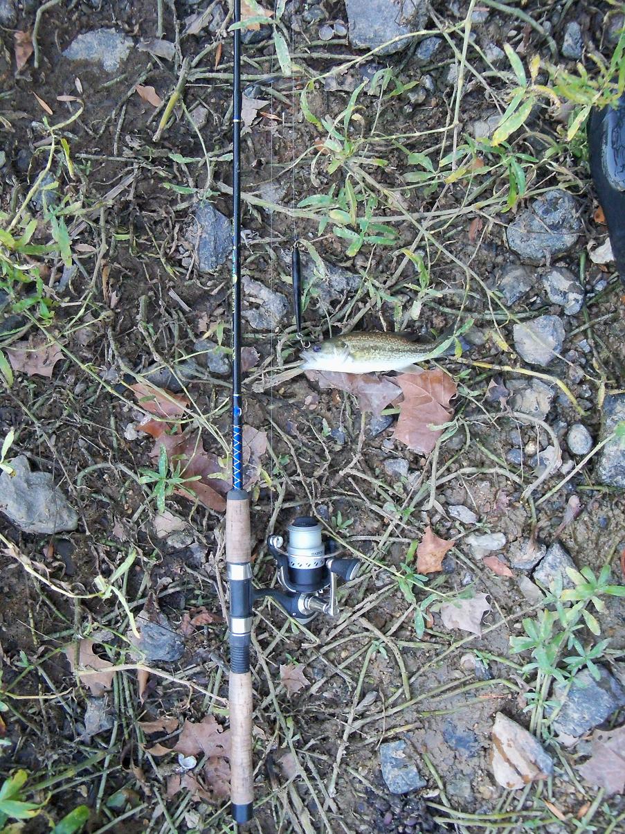
In late afternoon I wade back in. Planned to fish upstream but there are a couple guys fishing from shore under the bridge, so I go downstream instead. Shallow water at first, no bites for almost an hour. Are there really any bass in this river? Then I get a surface hit on the rap. Looks just like a LM to me. No reason to think it is a redeye. Nice little fish.

On the next cast I gat another surface hit, missed. I wade up about 1/2 mile, huge long pool here, never get to see the end. Sun is setting so I hustle back to the good pool below the bridge. I wade up from the tailout. finally get another hit, surface hit on the rap. Looks just like a SM to me, no reason to think it is a redeye.

I wade back out into the tailout. Sun going down now, fish are getting more agressive. Almost every cast to a new spot gets chased. I lose a pretty good one. They are hitting on top, but really timid about it. Another dinky surface hit. This one I hook. Looks like a LM, but it has bright red eyes. Micropterus coosae! Redeye - also called the Coosa bass. I have completed the Sequatchie Slam - LM, SM, and redeye in the same evening. The red eyes are not very visible in these pics.

I wade back out to the same spot, and the rap gets bit again. Tiny timid hit this time. It is a bluegill. Lepomis macrochirus. All bass are part of the sunfish family, and this is the most common sunfish. Nice one, big enough to fillet. Bluegills are great eating fish. How did he get all 3 prongs of the triple hook in that tiny mouth?

Love wading these little streams. Never know what you are going to catch next. Catching these little guys on this superb indian summer evening is more rewarding to me than catching big fish on a giant TVA lake. Autumn now, and there are leaves all over the water. I am catching lots of leaves all day. Then I hook something really weird. At first I think it is a leaf, but it is wiggling and squirming. Turns out to be a lamprey, first one I have ever seen in the wild. Bass are intelligent and sensitive creatures. Respect the camera and will sit still while you take their photograph. This lamprey will not stop squirming, so I can't get a good pic.

Lampreys are parasites that have rasping teeth. They attach themselves to larger fish with their suction cup mouth, and then suck the precious bodily fluids out of the unfortunate host. I have a hard time getting this guy unhooked without him attaching his sucker mouth to me and sucking out my precious bodily fluids.

Then I get another redeye, bigger this time, about 11". Definitely different from the LM or SM.


There is deeper, rockier water ahead under and past the bridge, and the other 2 fishermen are gone now. But too deep to wade either bank, so I have to get out of the water, crash bush, and walk over the bridge before I can start fishing again. Too dark now. I get one more SM, biggest of the day, about 12".

Love this river. Need a canoe or kayak to fish it properly. Beautiful fall evening on a really pretty stream, one that the TVA forgot to put a dam on.

Only caught dinkers, but caught 5 different species, 2 that I have never caught before. I feel like the king of the world.
I drive on Hwy 28 downriver in the dark, dodging W of Chattanooga towards Jasper and Kimball. Find a burger shop with WIFI connection, spend a couple hours uploading pics onto the blog. There is a rest stop shown on the freeway near here, but I see a big mall parking lot across the street where semis are parking. I can always slide the Bulship in next to these big rigs and know I will not be bothered.